.png)
Digital transformation in the maritime industry is becoming increasingly essential as vessel owners and operators demand accurate, reliable, and well-structured technical data. Responding to this need, GeoBIM Indonesia provides Scan to BIM services for marine vessels, enabling precise digital documentation based on existing conditions. This approach supports better asset understanding, informed decision-making, and long-term operational efficiency.
.png)
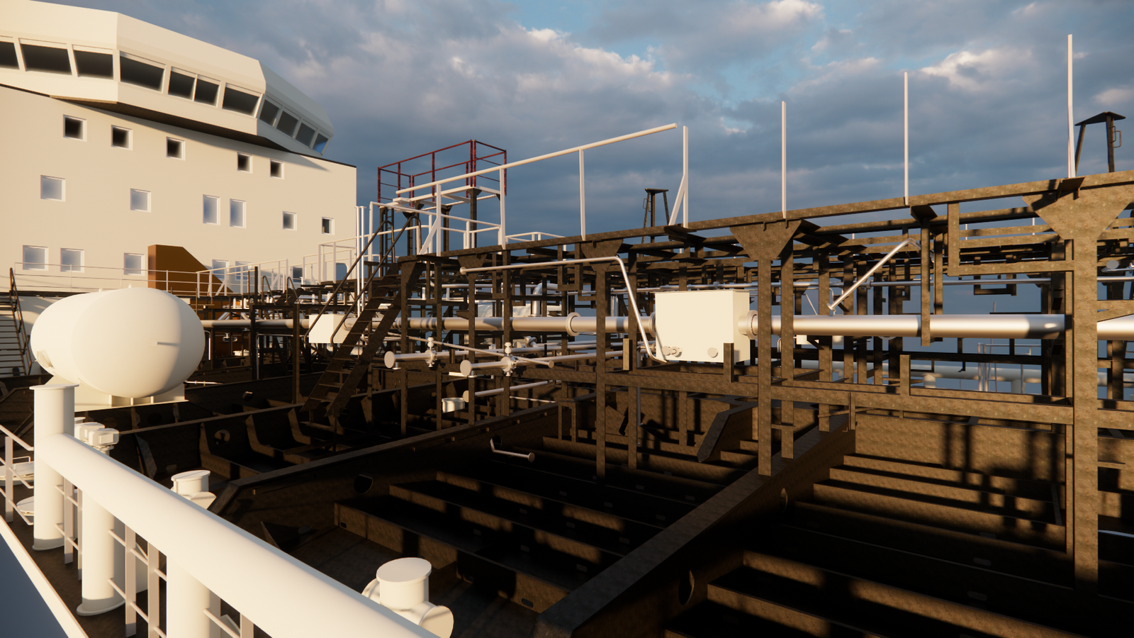
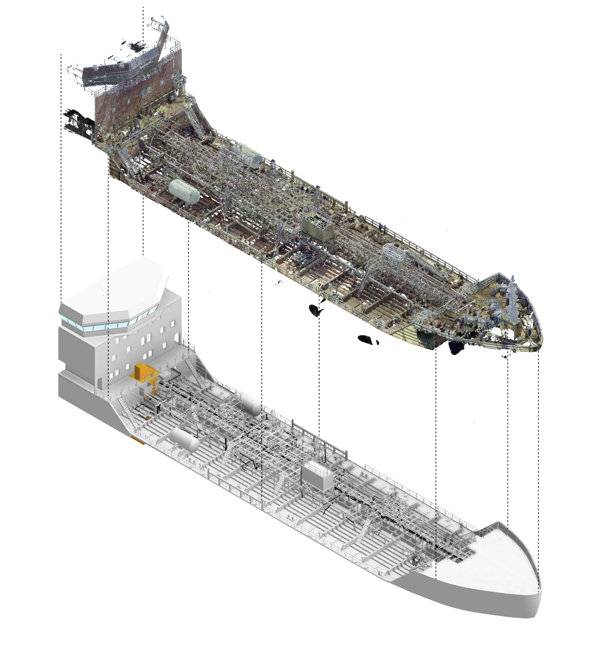
In collaboration with PT Terafulk Megantara Design, GeoBIM Indonesia developed a digital model of a marine vessel. The project scope covered the main deck structure, main deck systems, and the pump room, areas that require high accuracy due to their structural and operational complexity. The entire modeling process was based on existing-condition data, ensuring that the resulting BIM model accurately reflects the vessel’s current as-built condition.
The Scan to BIM workflow began with high-precision data acquisition using laser scanner technology. This method captures dense point cloud data that represents the actual geometry of the vessel, including hard-to-reach and highly detailed areas. Compared to conventional measurement methods, laser scanning significantly improves accuracy while reducing survey time and on-site disruption. The collected point cloud data was then processed and transformed into a comprehensive 3D modeling output within a BIM environment.
The resulting BIM model was developed according to defined LOD (Level of Development) requirements, ensuring that each modeled component contains the appropriate level of geometric detail and technical information. Proper LOD implementation allows stakeholders to clearly understand the condition of structural elements, mechanical systems, and critical components. Vessel owners can easily identify damaged areas, evaluate current performance, and compare the original design with the latest as-built condition.
Through this Scan to BIM implementation, GeoBIM Indonesia delivers comprehensive technical documentation that supports inspection activities, technical assessments, and renovation planning. The digital model serves as a reliable reference throughout the project lifecycle, reducing the risk of misinterpretation and minimizing errors during execution. By working from a single, accurate data source, coordination between owners, designers, and contractors becomes significantly more efficient.
Beyond design and renovation purposes, the BIM model plays a crucial role in facility management for marine vessels. It provides a structured digital foundation for long-term asset management, maintenance planning, and operational monitoring. Historical data, component information, and spatial relationships can be accessed easily, enabling proactive maintenance strategies and extending the service life of the vessel.
As a trusted BIM consultant, GeoBIM Indonesia combines advanced scanning technology, BIM expertise, and industry experience to deliver high-quality digital solutions across various sectors, including the maritime industry. This Scan to BIM project for a marine vessel demonstrates GeoBIM Indonesia’s capability to support complex assets with accurate, data-driven, and future-ready digital models, empowering owners to manage their vessels more efficiently, safely, and sustainably.