LiDAR
Problem We Solve
In many projects, conventional mapping faces limitations, such as slow data collection in large areas, extreme and dangerous terrain, dense vegetation, or the need for highly detailed data in a short period of time. Without the right technology, this process can take a long time and produce less accurate data. In addition, traditional methods require a lot of manpower in the field, which increases safety risks and operational costs. When speed and accuracy are crucial factors in planning and decision-making, these limitations can have a direct impact on overall project efficiency and success. LiDAR is here to solve these challenges. We help generate high-accuracy detailed topographic data, minimize the risk of human error, and accelerate the analysis and decision-making process in construction, infrastructure, forestry and mining projects.
How LiDAR Works?
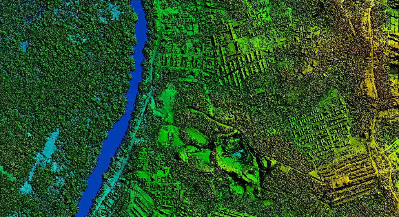
LiDAR works by measuring the travel time of a laser pulse from the sensor to the surface and back again. The sensors are usually mounted on drones, planes or ground vehicles. As it moves over the mapping area, the sensor emits a laser signal that hits various surfaces, such as the ground, trees, buildings, and returns to the receiver. Each reflection is recorded as a single data point with position information (X, Y, Z). These hundreds of thousands to millions of points then form a point cloud that represents the shape of terrain or objects in great detail.
Benefits Using LiDAR
Fast data capture
Thousands of hectares can be mapped in just hours.
High accuracy
Produces precise data down to the centimeter level, even in vegetation-covered areas.
High detail and resolution
Captures terrain shapes and objects in great detail.
Efficient and cost-effective
Reduce field labor requirements and speed up data processing.
LiDAR Survey Flow
Preparation Survey
Determine flight paths, prepare equipment
Control Point Survey
Measuring control points using Geodetic GPS
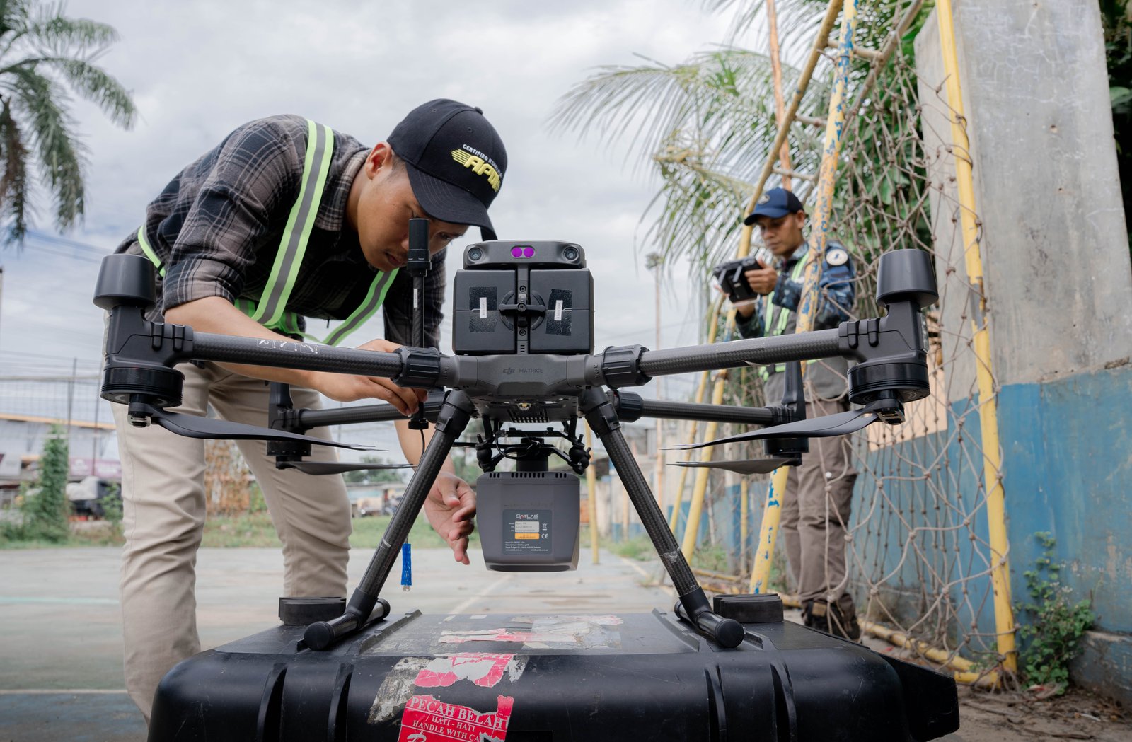
LiDAR Survey
Data collection using LiDAR, scanning the ground surface
Registering Point Cloud
Merge and align point clouds
Point Cloud Classification
Sorting point clouds based on their objects
Build DEM, DTM, Contour
Creating the final product: DEM, contour map, and topographic map
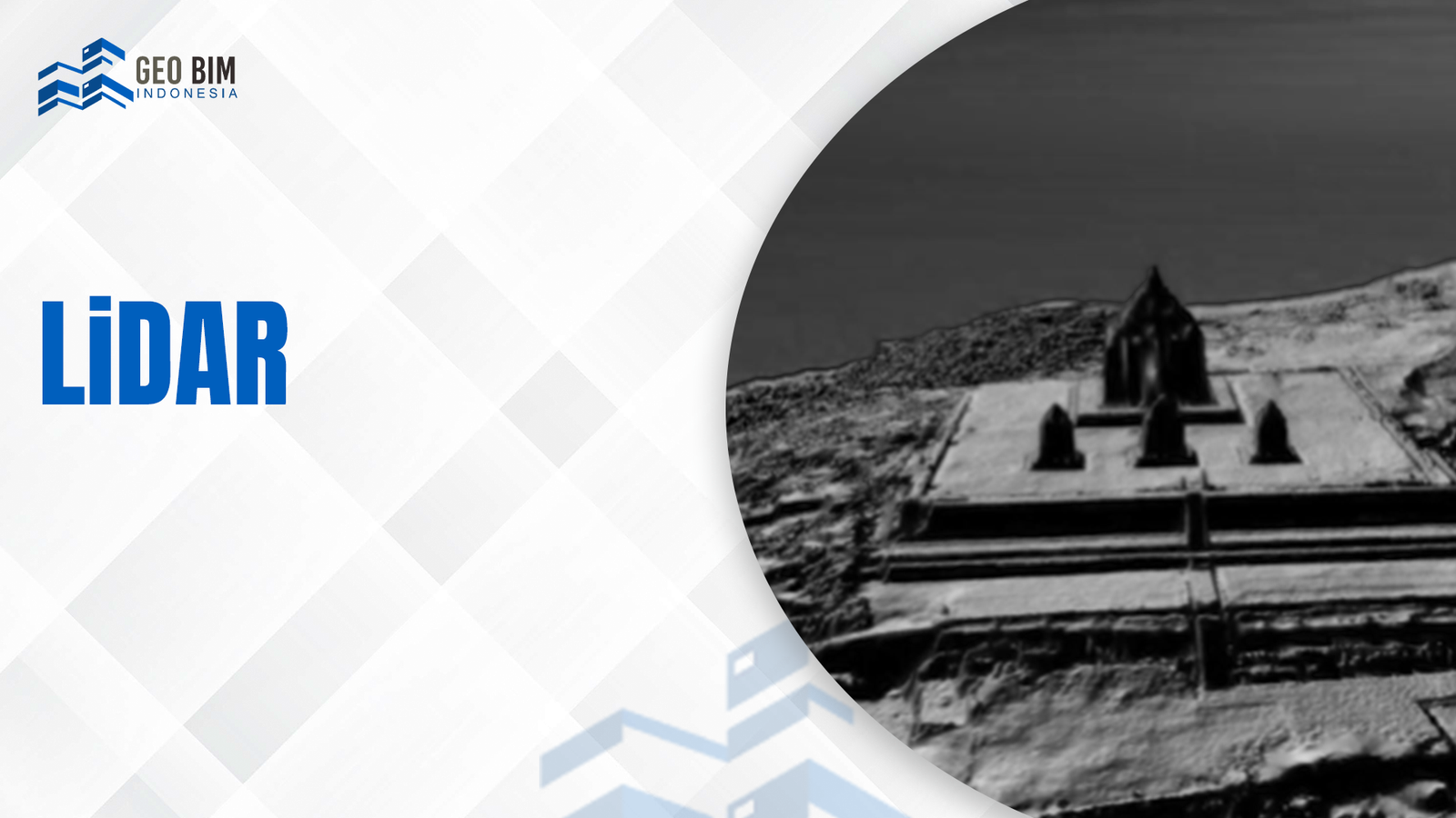
Sample LiDAR