Infrastructure
Build the Future with Unmatched Precision and
Seamless Project Control
Ready to build more resilient, efficient and sustainable infrastructure?
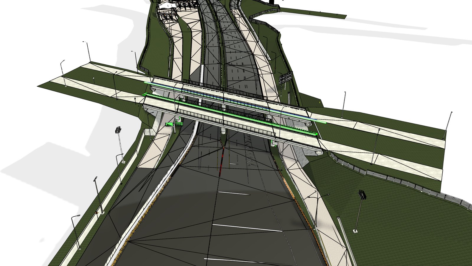
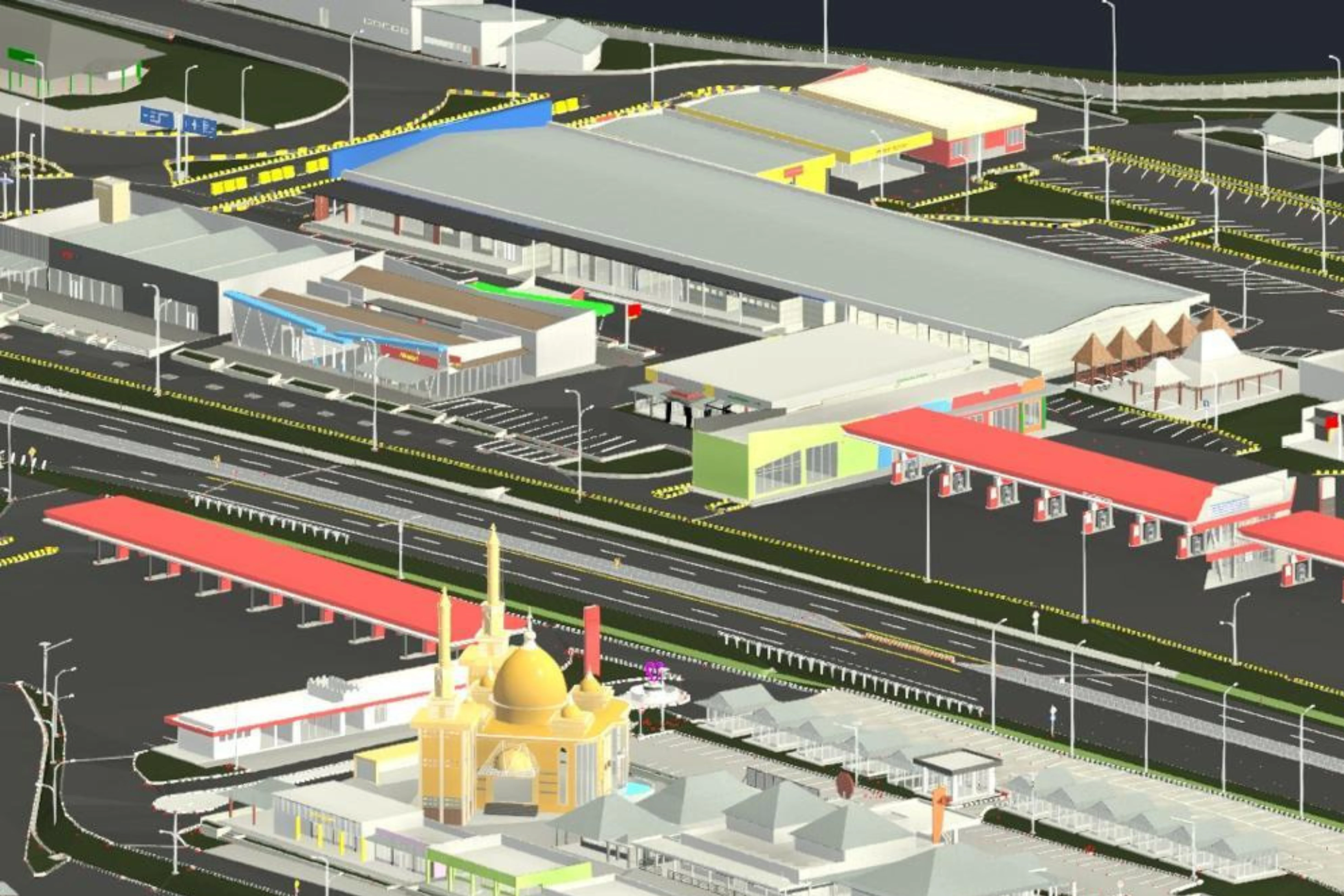
Infrastructure projects bring huge challenges that demand precision, efficiency and intense coordination. This is where Building Information Modeling (BIM) creates a comprehensive, intelligent digital model for your entire project. Imagine all components, from the bridge structure, to the road lining, to every underground utility pipe and cable, represented in one unified system.
Benefits of BIM for Infrastructure:
1. Accurate Planning & Design: BIM helps provide an accurate picture of the topography, ground conditions and existing assets. design routes and locations with precision, even in the most challenging environments.
2. Early Conflict Detection: Our system is able to identify conflicts between infrastructure elements (e.g., new pipes with old cables, bridge piers with utility networks). This means no more rework that disrupts schedules and budgets in large-scale projects.
3. Optimal Schedule (4D BIM): Visualize each stage of construction, identify potential logistical bottlenecks, and dynamically optimize the project schedule. Your infrastructure project will be completed on time, even faster, saving you millions of dollars.
4. Accurate Cost Estimation (5D BIM): Get accurate calculations of work volume and materials, giving you tight budget control and reducing the risk of cost overruns.
5. Cross-Discipline Collaboration and Communication: The entire team can work on one unified platform, from architects to contractors can easily communicate and coordinate to make the right decisions.
6. Asset Management and Long-term Maintenance: BIM helps track asset conditions in real time, for maintenance of infrastructure assets so as to extend asset life and reduce operational costs.
Sample Project Infrastructure
Point Cloud
Let’s observe how toll roads can be mapped in detail through Scan to BIM technology. The point cloud captures the entire road alignment—lanes, curves, shoulders, and elevation changes—with high precision. It also records critical features like markings, median barriers, drainage, and signage. This accurate data becomes a reliable foundation for creating 3D models that support design validation, construction planning, and long-term maintenance of toll road infrastructure.
3D Model
Let’s explore how BIM transforms toll roads into intelligent 3D models. From lanes and interchanges to bridges, drainage systems, and roadside features—each element is modeled with precision. These comprehensive digital representations enable better coordination, accurate analysis, and informed decision-making throughout the project lifecycle. With BIM, toll road infrastructure can be planned, monitored, and maintained more efficiently and sustainably.