
Panorama Walktrough
Problem We Solve
Static project documentation is often unable to convey field conditions thoroughly and contextually. This results in limited visibility, sub-optimal coordination, and hindered decision-making. In addition, the need for repeated site visits adds to the time and cost burden. Panorama Walkthrough service provides an immersive, accurate, and digitally accessible 360° visualization solution to improve communication efficiency and project supervision.
How Panorama Walkthrough Works
These panoramic views are created by stitching together multiple images or rendering a scene directly from your BIM model, resulting in a continuous 360-degree perspective. What's more, they can be viewed and navigated seamlessly across a wide range of devices, including desktop computers, smartphones, tablets, and VR headsets.
Key Benefits of Panorama Walkthrough
Visual Access Without Being On-Site
Stakeholders can monitor the project from anywhere without the need for field visits.
Enhanced Transparency and Collaboration
All parties have access to the latest conditions in real-time and objectively.
Improved Progress Tracking
360-degree documentation over time helps compare project progress.
Enhance Marketing Efforts
Provide high-quality visual content that truly stands out.
Panorama Walkthrough Flow
Planning & Positioning
Determine the 360° shooting points based on the layout or important areas.
Image Capture
Taking photos using a 360° camera with high resolution.
Data Processing
Arrange and connect points into an interactive navigation path.
Platform Integration
Inputting walkthrough results to a system that can be accessed via web or cloud.
Review & Sharing
Gives access to the project team or client to view and give notes.
Sample Panorama Walkthrough
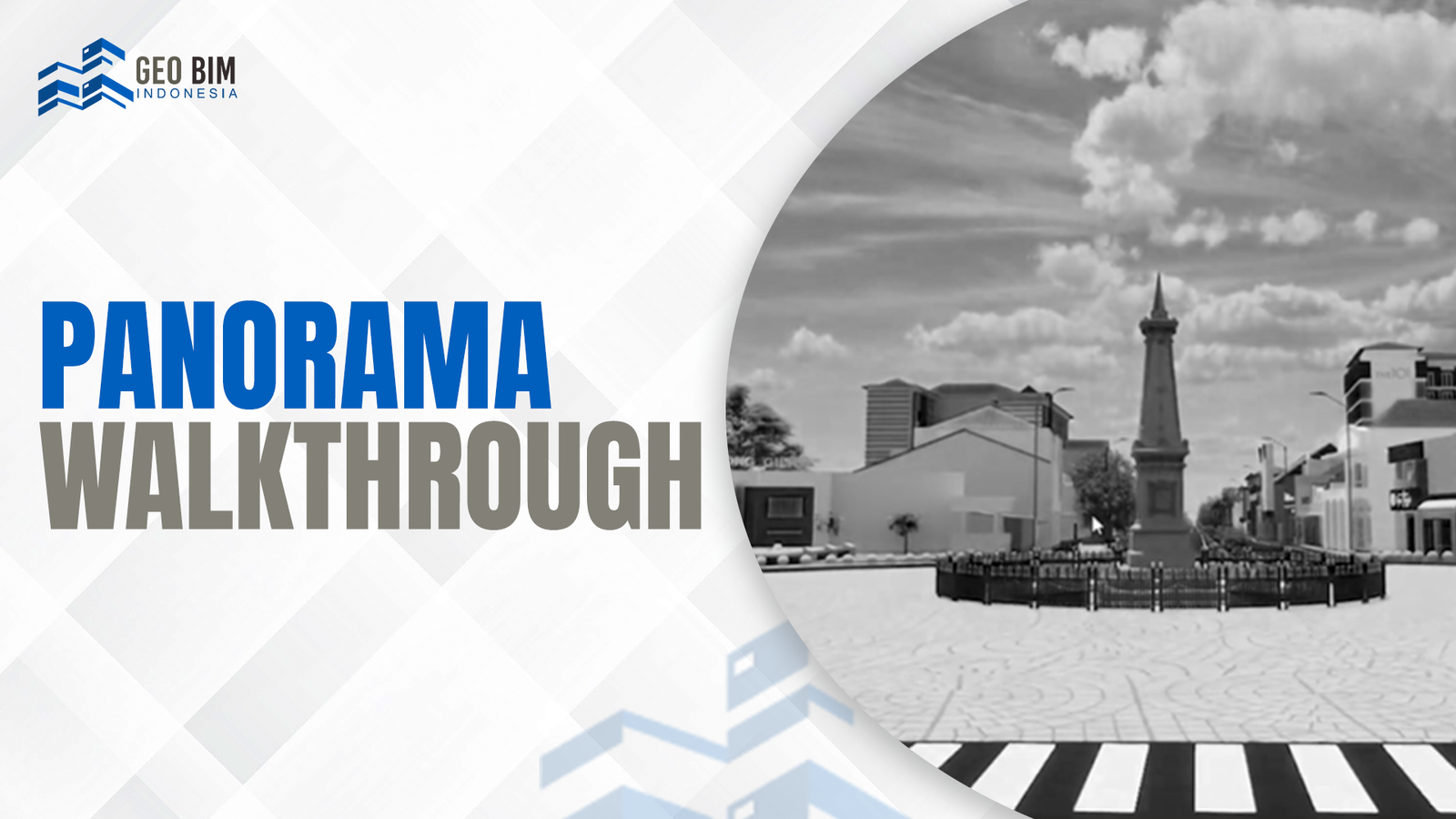
Cosmological Axis of Yogyakarta
Experience an immersive virtual journey along the imaginary north-south line—from the Tugu Monument to the Krapyak Stage. Step into the spiritual and cultural essence of the city, reimagined in a detailed 3D digital space.
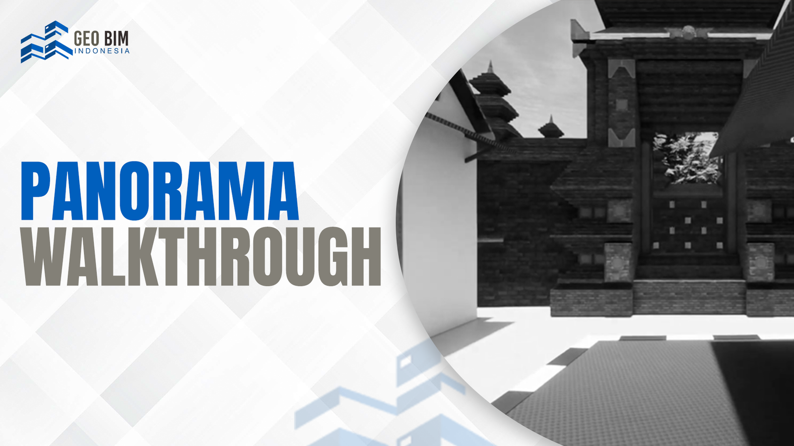
Gede Mataram Mosque Heritage
Explore one of the oldest mosques in Yogyakarta. This walkthrough allows you to study the traditional architectural style of the Mataram Islamic Kingdom from anywhere, preserving cultural heritage through digital modeling.