.webp)
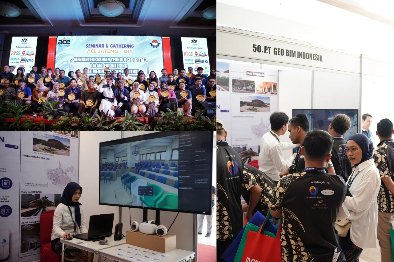
GeoBIM Indonesia successfully carried out the development of Provincial Road Ledger documentation in the Ngawi area as part of fulfilling the infrastructure data requirements of the Dinas Pekerjaan Umum Bina Marga Provinsi Jawa Timur. This activity aimed to provide accurate, well-structured road documentation that can be utilized as a basis for infrastructure asset management and planning using Building Information Modeling (BIM).
The scope of work included the documentation of five provincial road sections, namely Jalan Gubernur Suryo, Jalan Panglima Besar Sudirman, Jalan Ahmad Yani, Jalan Basuki Rachmad, and Jalan Sukowati. The total documented road length reached 7.058 kilometers, with the implementation of Level of Detail (LOD) 350, enabling the resulting models to represent road geometric elements and attributes in sufficient detail to meet road ledger documentation requirements.
.webp)
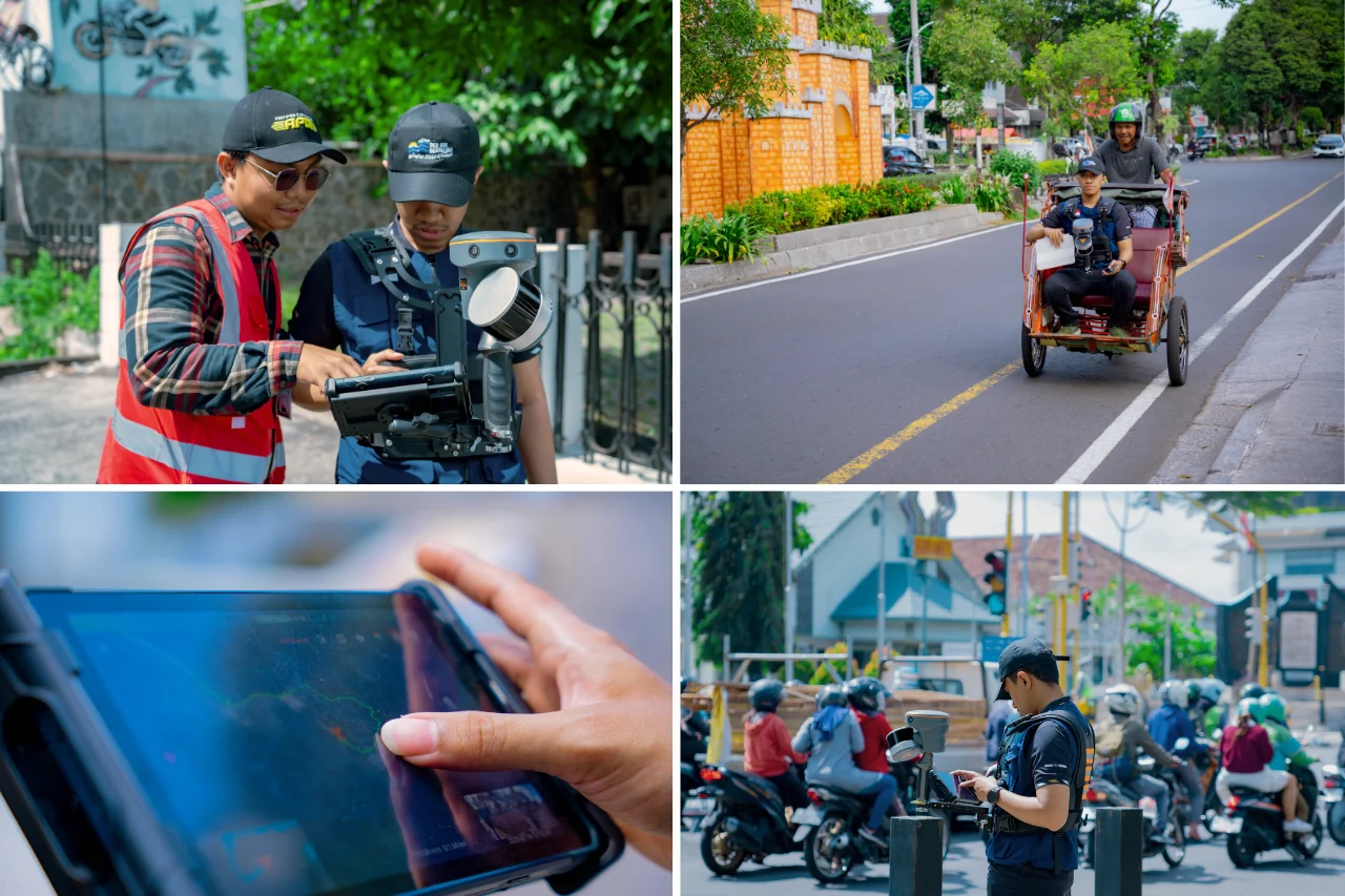
In its implementation, GeoBIM Indonesia utilized a combination of Real-Time Kinematic (RTK) measurements and LiDAR point cloud data as the primary data sources. RTK measurements were conducted to obtain precise coordinates and elevation data of road assets. Meanwhile, LiDAR point cloud data was processed to comprehensively and accurately capture the existing conditions of the roads and their surrounding environment.
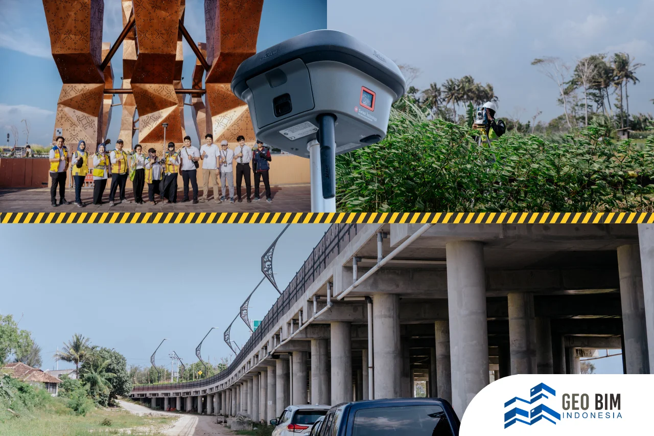
All measurement and acquisition data were subsequently processed and modeled using BIM software. The LiDAR point cloud data was further processed to produce an integrated 3D Road Ledger Model, allowing each road element to be visualized and analyzed in three dimensions.
The outputs of this project included Road Ledger Documentation, point cloud data, CAD drawings, 3D models, and 360-degree images, providing a comprehensive visualization of road conditions. The entire workflow, from data acquisition to the completion of final documentation, was successfully completed within 60 days, demonstrating the effectiveness of applying BIM and LiDAR technologies in road infrastructure documentation.
.webp)
Through this project, GeoBIM Indonesia reaffirmed its capability in delivering accurate and technically compliant BIM-based Road Ledger solutions, supported by RTK, point cloud, and LiDAR technologies. This approach enables more modern, integrated road asset management and supports sustainable planning and maintenance of provincial road infrastructure.