In infrastructure projects such as bridges, data accuracy is the top priority. Even the smallest error in the model can significantly affect structural analysis, cost estimation, and future reconstruction planning. That is why GeoBIM Indonesia is committed to delivering precise, verified, and high-quality data, even under the most challenging field conditions. This commitment forms the foundation of every project we undertake, ensuring that each result not only meets technical standards but also provides strategic value for decision-making in both the planning and construction stages.
Capturing Existing Conditions through 3D Scanning Technology
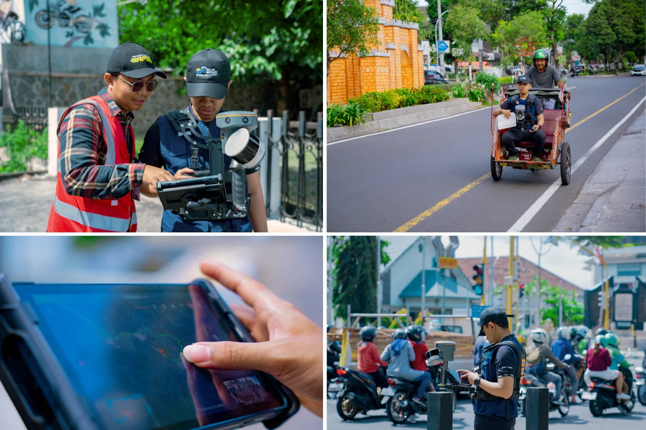
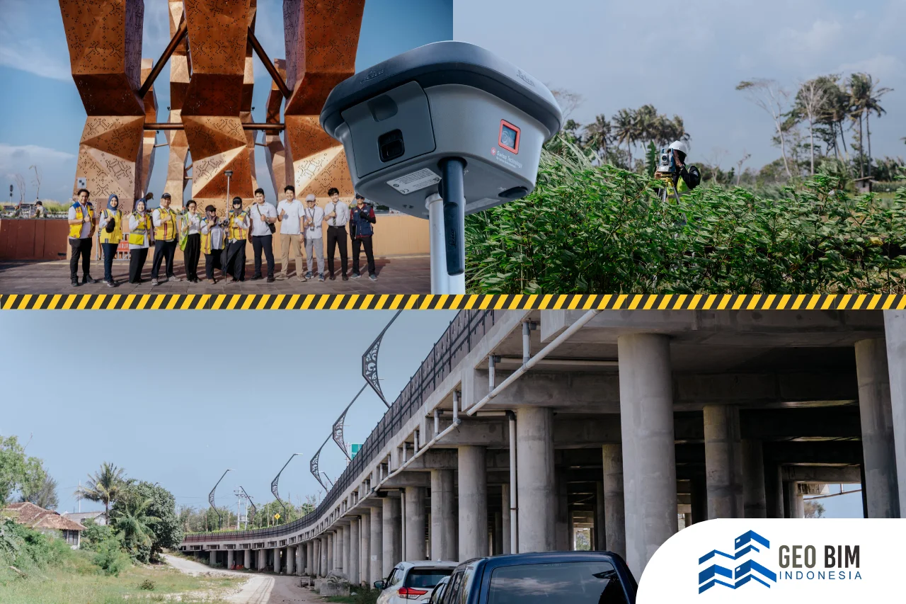
Through 3D Scanning technology, GeoBIM Indonesia accurately captures the existing condition of structures in the form of a detailed 3D point cloud. This technology enables comprehensive documentation of every bridge element, from the main structure to the smallest details quickly, efficiently, and accurately.
In the 3D Scanning Project of Pandansimo Bridge, GeoBIM Indonesia’s team carried out a full survey using the Terrestrial Laser Scanner (TLS) : Leica RTC360. This advanced 3D Laser Scanner can record millions of data points within minutes, providing exceptional accuracy while minimizing human error. Using a Scan to BIM approach, the entire documentation process becomes more structured and efficient, resulting in a 3D model ready for technical analysis, planning, and maintenance.
Field Innovation: 3D Scanning from the Water
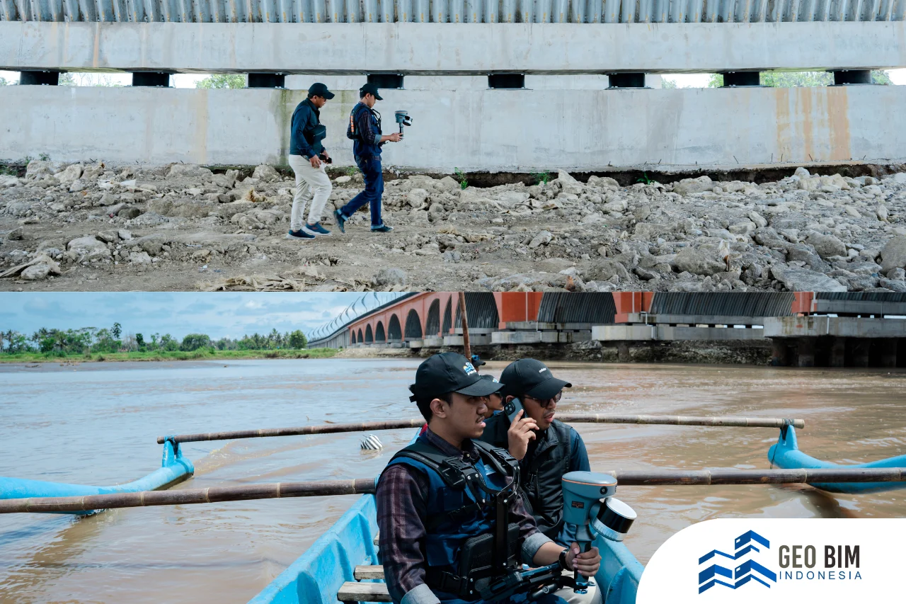
A unique challenge arose when the team needed to scan the underside of the Pandansimo Bridge, an area inaccessible by land. However, such terrain limitations never compromise GeoBIM Indonesia’s commitment to data quality. Instead, they inspire innovation in the field.
As a solution, the team adopted a new approach by operating 3D Mobile Laser Scanning technology from a boat. This method enables full coverage of the bridge’s underside without the need for direct physical access to high-risk areas, while maintaining data accuracy, density, and consistency.
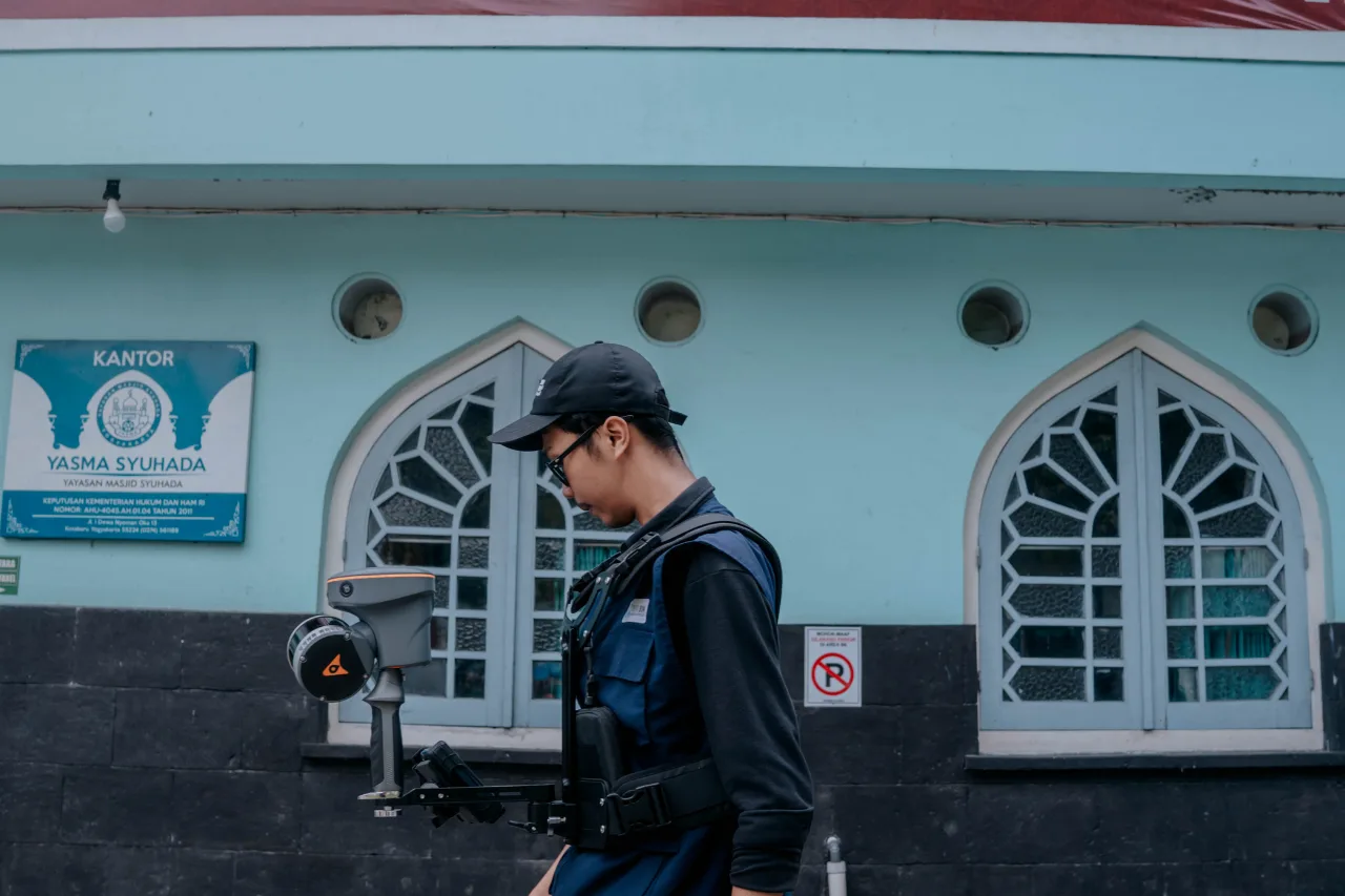
During the field operation, GeoBIM Indonesia utilized the Mobile SLAM RS10, a portable and user-friendly device capable of collecting real-time point cloud data with up to 2 cm accuracy, even without GNSS support. This technology provides an effective solution for areas with limited satellite signals, such as under bridges or enclosed environments.
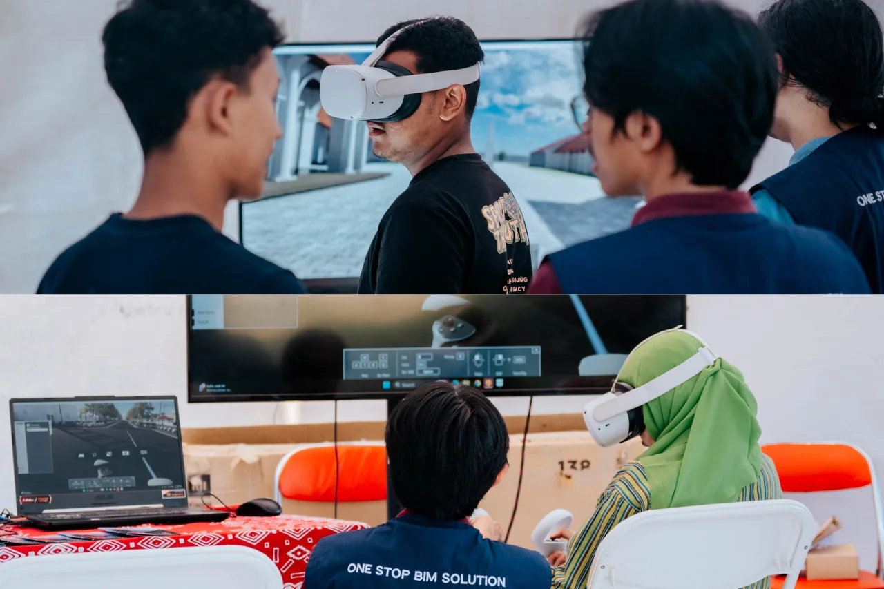
By combining technical precision and field creativity, GeoBIM Indonesia demonstrates that high-quality data can always be achieved, regardless of environmental challenges. This innovative approach not only expands the survey’s reach but also accelerates data acquisition time, without compromising the crucial spatial details needed for structural bridge analysis.
GeoBIM Indonesia: Trusted Provider of BIM and Scan to BIM Services
For GeoBIM Indonesia, every detail matters, because complete data is the foundation of a reliable model. As a professional provider of BIM and Scan to BIM services, GeoBIM Indonesia is dedicated to delivering digital solutions for national infrastructure projects. Combining 3D Laser Scanning, drone mapping, and BIM integration, we ensure that each project has spatial data that is precise, efficient, and ready to use. The result is a high-accuracy <a href="In infrastructure projects such as bridges, data accuracy is the top priority. Even the smallest error in the model can significantly affect structural analysis, cost estimation, and future reconstruction planning. That is why GeoBIM Indonesia is committed to delivering precise, verified, and high-quality data, even under the most challenging field conditions. This commitment forms the foundation of every project we undertake, ensuring that each result not only meets technical standards but also provides strategic value for decision-making in both the planning and construction stages.
Capturing Existing Conditions through 3D Scanning Technology
Through 3D Scanning technology, GeoBIM Indonesia accurately captures the existing condition of structures in the form of a detailed 3D point cloud. This technology enables comprehensive documentation of every bridge element, from the main structure to the smallest details quickly, efficiently, and accurately.
In the 3D Scanning Project of Pandansimo Bridge, GeoBIM Indonesia’s team carried out a full survey using the Terrestrial Laser Scanner (TLS) : Leica RTC360. This advanced 3D Laser Scanner can record millions of data points within minutes, providing exceptional accuracy while minimizing human error. Using a Scan to BIM approach, the entire documentation process becomes more structured and efficient, resulting in a 3D model ready for technical analysis, planning, and maintenance.
Field Innovation: 3D Scanning from the Water
A unique challenge arose when the team needed to scan the underside of the Pandansimo Bridge, an area inaccessible by land. However, such terrain limitations never compromise GeoBIM Indonesia’s commitment to data quality. Instead, they inspire innovation in the field.
As a solution, the team adopted a new approach by operating 3D Mobile Laser Scanning technology from a boat. This method enables full coverage of the bridge’s underside without the need for direct physical access to high-risk areas, while maintaining data accuracy, density, and consistency.
During the field operation, GeoBIM Indonesia utilized the Mobile SLAM RS10, a portable and user-friendly device capable of collecting real-time point cloud data with up to 2 cm accuracy, even without GNSS support. This technology provides an effective solution for areas with limited satellite signals, such as under bridges or enclosed environments.
By combining technical precision and field creativity, GeoBIM Indonesia demonstrates that high-quality data can always be achieved, regardless of environmental challenges. This innovative approach not only expands the survey’s reach but also accelerates data acquisition time, without compromising the crucial spatial details needed for structural bridge analysis.
GeoBIM Indonesia: Trusted Provider of BIM and Scan to BIM Services
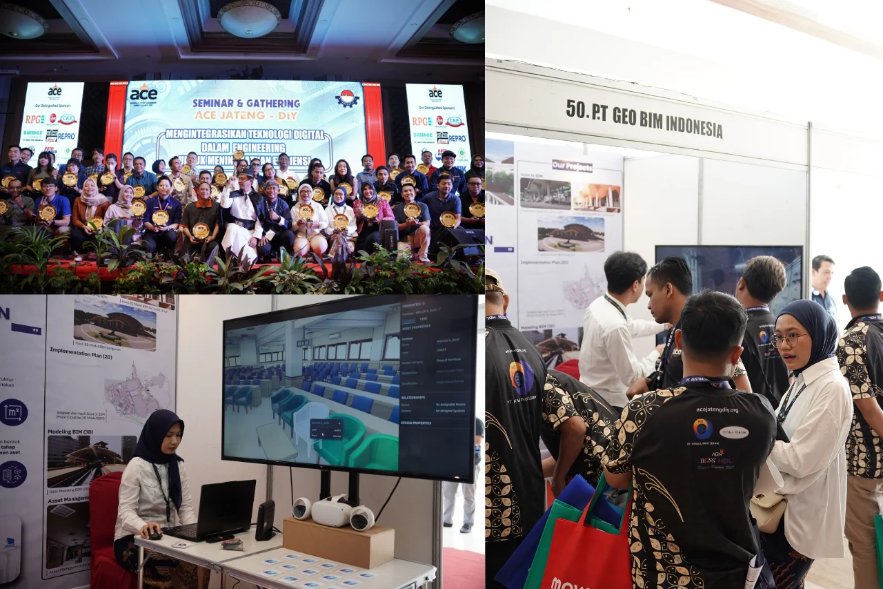
For GeoBIM Indonesia, every detail matters, because complete data is the foundation of a reliable model. As a professional provider of BIM and Scan to BIM services, GeoBIM Indonesia is dedicated to delivering digital solutions for national infrastructure projects. Combining 3D Laser Scanning, drone mapping, and BIM integration, we ensure that each project has spatial data that is precise, efficient, and ready to use. The result is a high-accuracy as-built 3D model that supports better planning, reconstruction, and asset maintenance.
As Building Information Modeling (BIM) becomes increasingly essential in the digital transformation of the construction sector, GeoBIM Indonesia stands as a trusted partner capable of managing the entire Scan to BIM workflow, from laser scanning and point cloud processing to detailed BIM modeling that reflects real-world conditions.
Backed by advanced technology and an experienced professional team, GeoBIM Indonesia ensures every project is executed with high precision and in compliance with national BIM standards. Clients can rest assured that technical complexities are fully handled as GeoBIM transforms field data into ready-to-use digital models that are fast, practical, and of exceptional quality.
Contact GeoBIM Indonesia today and get the best documentation solution for your project!
📞 +62 838-3866-5598 (Sales Engineer – GeoBIM Indonesia)" target="_blank">as-built 3D model that supports better planning, reconstruction, and asset maintenance.