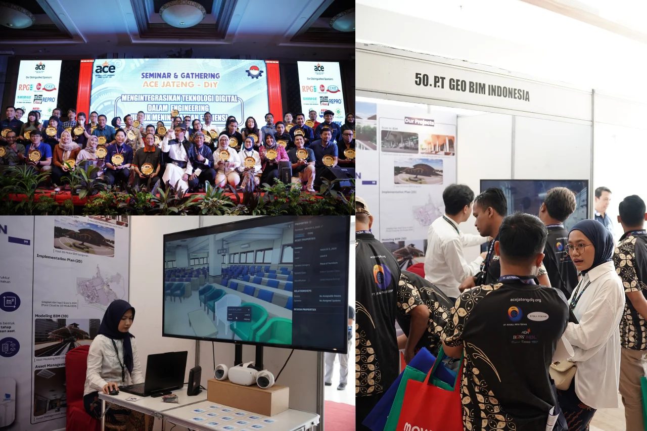
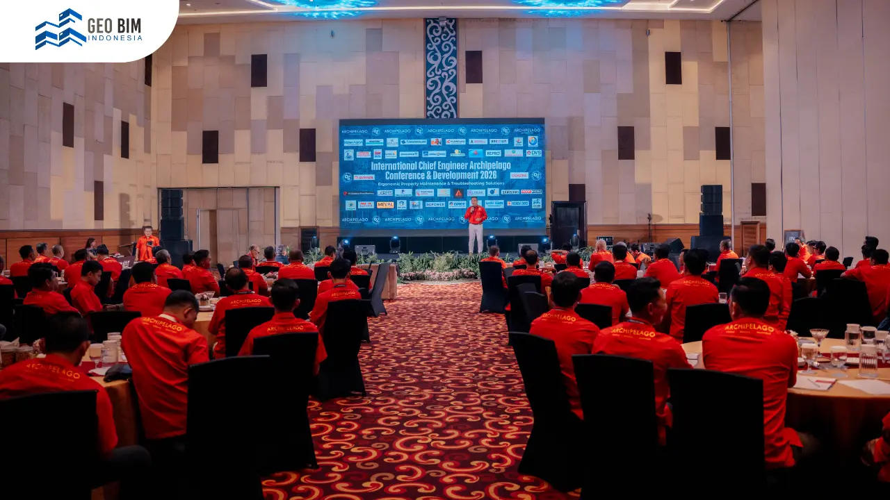
International Chief Engineer Archipelago Conference 2026 served as an important forum for chief engineers, construction practitioners, and property professionals. The event was held at The Alana Yogyakarta Hotel & Convention Center on 21 April 2026, under the theme “Ergonomic Property Maintenance & Troubleshooting Solution.” The discussion focused on improving efficiency in modern building management and maintenance.
At this event, GeoBIM introduced digital solutions centered on 3D Scanning, 3D Modeling, As-Built Drawing, and SLF (Building Function Feasibility Certificate). These technologies are designed to help the construction industry obtain more accurate building data. They also support faster and more measurable maintenance workflows.
GeoBIM emphasized the importance of integrated digital building data throughout the asset lifecycle. When information is well-structured and continuously updated, issue identification becomes significantly faster. This leads to better decision-making in field operations and facility management.
3D Scanning and 3D Modeling for Building Maintenance
The demand for precise building data in the property industry continues to grow every year. GeoBIM addresses this need through 3D Scanning, which captures existing building conditions in high detail. This process delivers faster and more accurate results compared to conventional surveying methods. The scanned data is then processed into 3D Modeling, which represents the actual building condition in a digital form. These models contain both geometric and visual information. As a result, damage analysis and troubleshooting processes become more efficient and structured.
This technology also reduces errors in field data collection. Every building element can be documented comprehensively in a single digital system. This significantly improves the overall maintenance workflow.
The adoption of 3D Scanning and 3D Modeling is transforming the construction industry. Documentation processes are now faster, more accurate, and more reliable. This improves the overall quality of data used for planning and decision-making. Digital building data is not only used for maintenance purposes. It is also valuable for renovation planning, technical audits, and long-term asset management. With a single source of truth, operational efficiency increases significantly.
GeoBIM demonstrates that digital transformation in the construction sector is no longer optional. The integration of spatial data and 3D models is becoming a new standard in modern property management. This shift enables smarter and more efficient building operations.
Accurate As-Built Drawing for Construction Projects
One of GeoBIM’s key focuses at the conference was improving As-Built Drawing accuracy. In many construction projects, discrepancies often exist between design drawings and actual site conditions. This makes traditional documentation methods less reliable for technical decision-making.
Through 3D Scanning, GeoBIM captures complete and real-time building conditions. The data includes dimensions, structural elements, and architectural details. This information is then processed into highly accurate As-Built Drawings. Accurate As-Built Drawings are essential for renovation, building audits, and asset management. With reliable documentation, planning processes become faster and more precise. This also reduces risks during field execution.
SLF Supported by 3D Data
GeoBIM also introduced its SLF (Building Function Feasibility Certificate) service as a key part of building lifecycle management. SLF is an official document confirming that a building meets safety, functionality, and technical standards. This process requires complete and verifiable technical data.
Through 3D Scanning and 3D Modeling, GeoBIM provides detailed building condition data. This supports faster and more transparent inspection processes. It also simplifies technical validation during certification. This digital-driven workflow helps reduce challenges in the SLF submission process. All building information is available in a structured and easily analyzable digital format. This significantly improves certification efficiency.
Handheld SLAM RS10 Demonstration
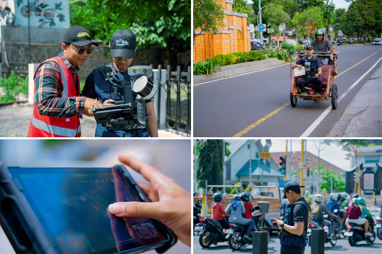
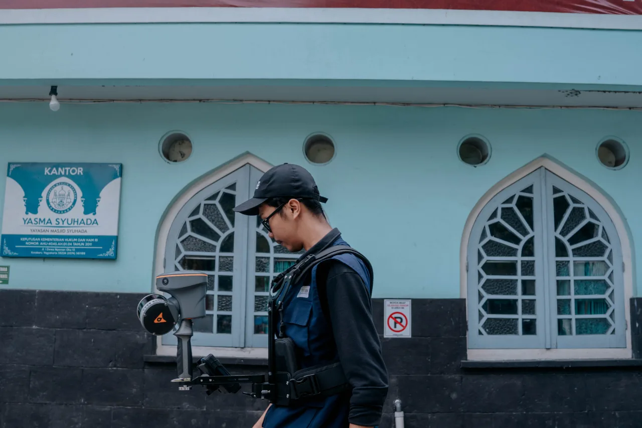
During the International Chief Engineer Archipelago Conference 2026, GeoBIM also showcased the Handheld SLAM RS10 technology. This device is a portable 3D scanner capable of capturing real-time building conditions. It became one of the highlights of the exhibition session.
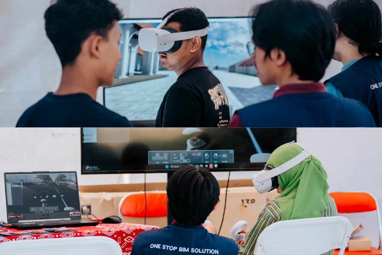
Participants at The Alana Yogyakarta Hotel & Convention Center had the opportunity to try the device directly. The scanning results were instantly displayed as detailed 3D models. This demonstrated how building documentation can be performed in real time.
The technology is highly effective for hard-to-reach areas and large-scale projects. It also significantly speeds up field inspection processes. This leads to a more efficient and streamlined workflow.
GeoBIM Indonesia: Your Strategic Partner for As-Built Drawing & SLF Solutions
GeoBIM Indonesia provides professional services in 3D Scanning, 3D Modeling, As-Built Drawing, and SLF (Building Function Feasibility Certificate). These services help the construction industry obtain accurate and reliable building data. With advanced digital technology, building asset management becomes more efficient and structured.
GeoBIM Indonesia also supports detailed and well-organized building documentation needs. The resulting data can be used for maintenance, renovation planning, and long-term asset development. This positions GeoBIM as a strategic partner in modern property management.
If you need fast, accurate, and reliable 3D Scanning and SLF solutions, GeoBIM Indonesia is ready to assist. Consult your project needs with our professional team to find the best solution.
Consult your 3D Scanning needs with GeoBIM Indonesia to achieve accurate and efficient results.
📞 082134939917 (Sales Engineer GeoBIM)