.webp)
Wates City Center is part of the Satuan Ruang Strategis which has high historical value. This area not only preserves various colonial-era heritage buildings but also serves as the administrative center of Kulon Progo Regency. With this strategic role, the development of the Wates area requires a more modern and digital planning approach.
Conventional approaches in area planning are often not sufficient to address the complexity of current needs. Therefore, the development of Wates City Center is carried out through the creation of a digital area model using Building Information Modeling (BIM) technology. This approach enables the integration of spatial and visual data comprehensively, supporting a more accurate and efficient planning process.
As part of a Satuan Ruang Strategis, Wates requires detailed and accountable data. This data becomes the basis for various aspects, ranging from the conservation of historic buildings to the development of urban infrastructure. Without accurate data, the risk of errors in planning will be higher. Through BIM technology, all area information can be integrated into a structured system. This allows collaboration among stakeholders to be more effective while minimizing potential errors in the design and construction process.
.webp)
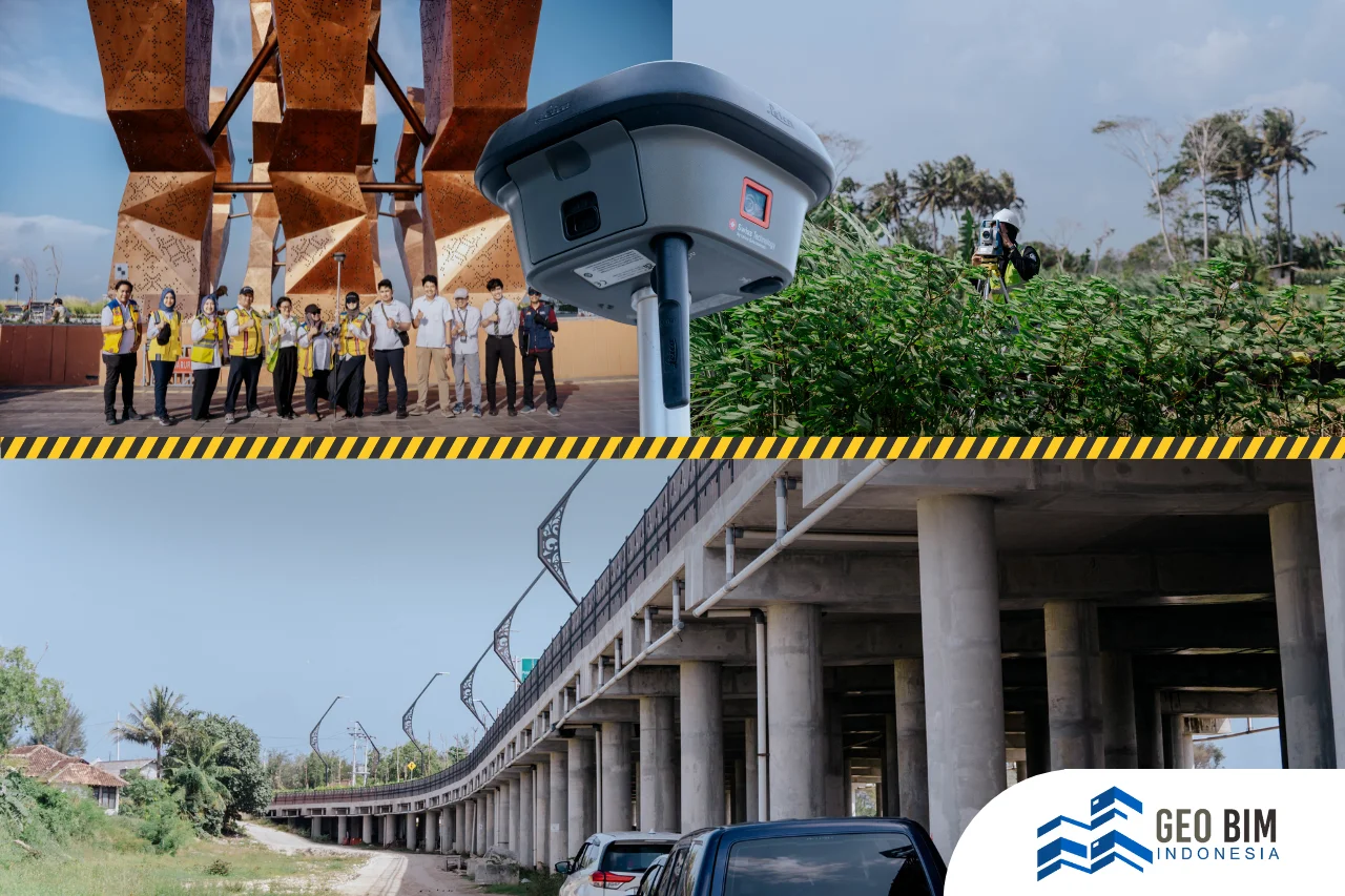
3D Scanning and Modeling of the Wates Area
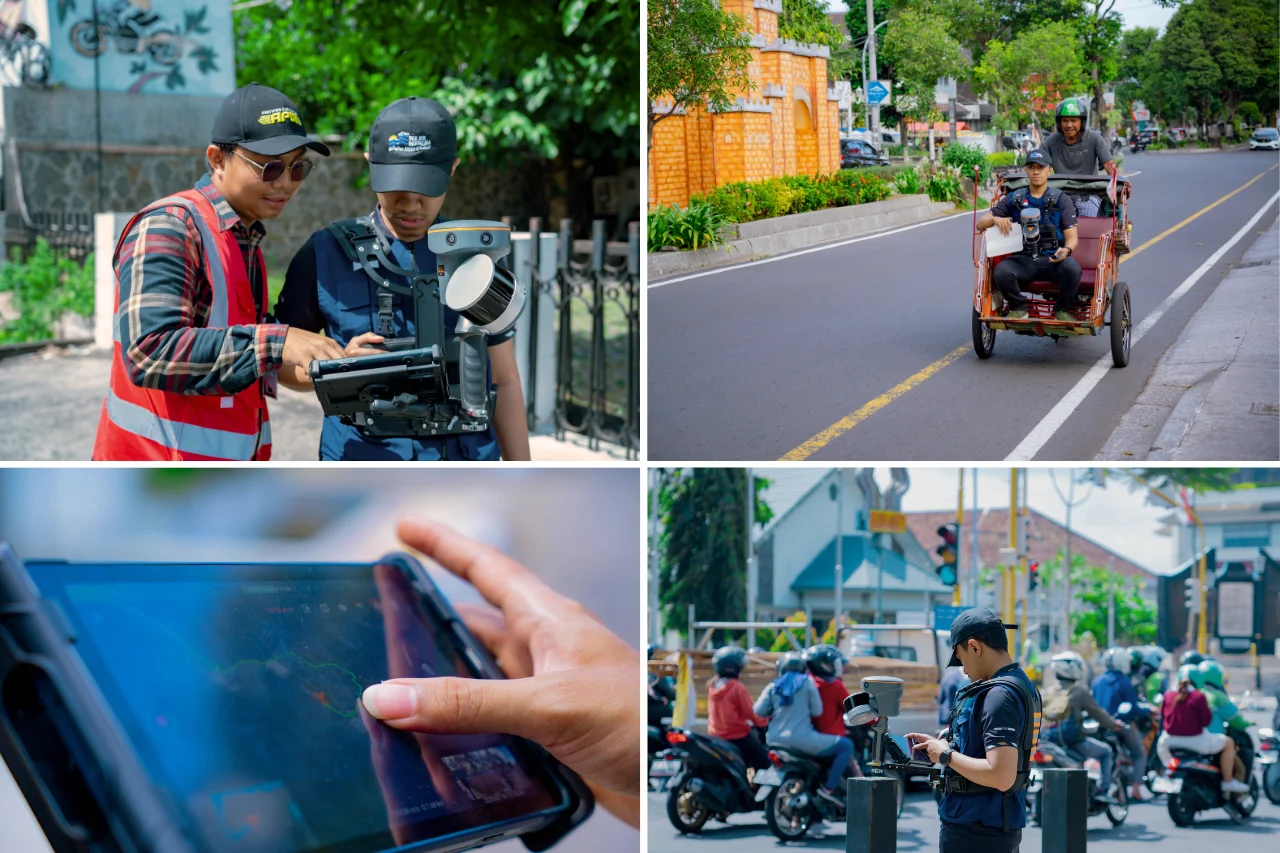
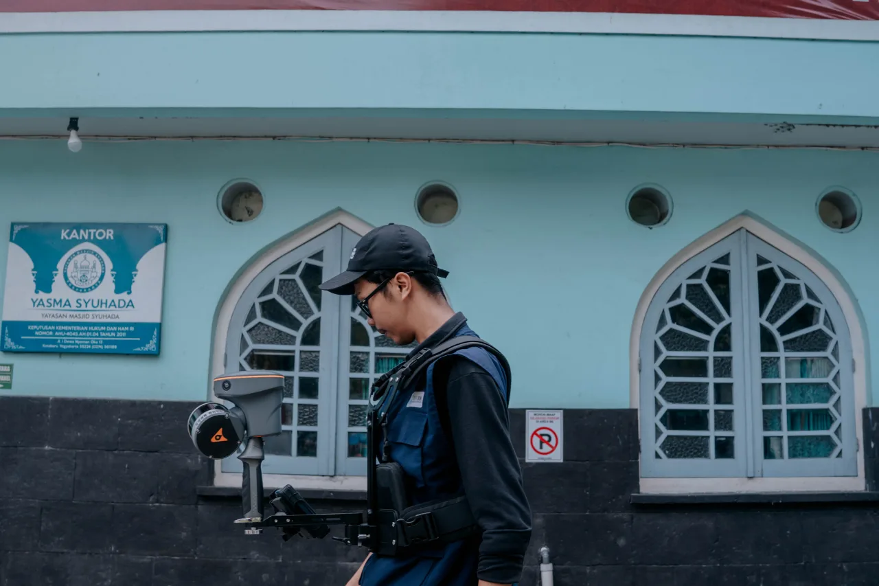
The process of creating the digital area model begins with 3D scanning to capture existing conditions in detail. This technology is capable of producing visual representations in the form of highly precise point clouds, reflecting real conditions in the field.
The 3D scanning activity was carried out on several important objects in the Wates area, including:
- Bale Agung Museum
- Bulurejo Heritage Site
- Pagoda Monument
- Wates Subdistrict Office
- Wates Station
- Jami Mosque Wates
- Town Square and Kulon Progo Government Area
These objects were selected because they have historical value, strategic functions, and serve as centers of community activity. By scanning these points, a comprehensive overview of the structure and characteristics of the area is obtained.
The result of the 3D scanning process is a point cloud which is then integrated with LiDAR data. The combination of these two technologies provides advantages in terms of accuracy and data coverage, both for building details and area topography.
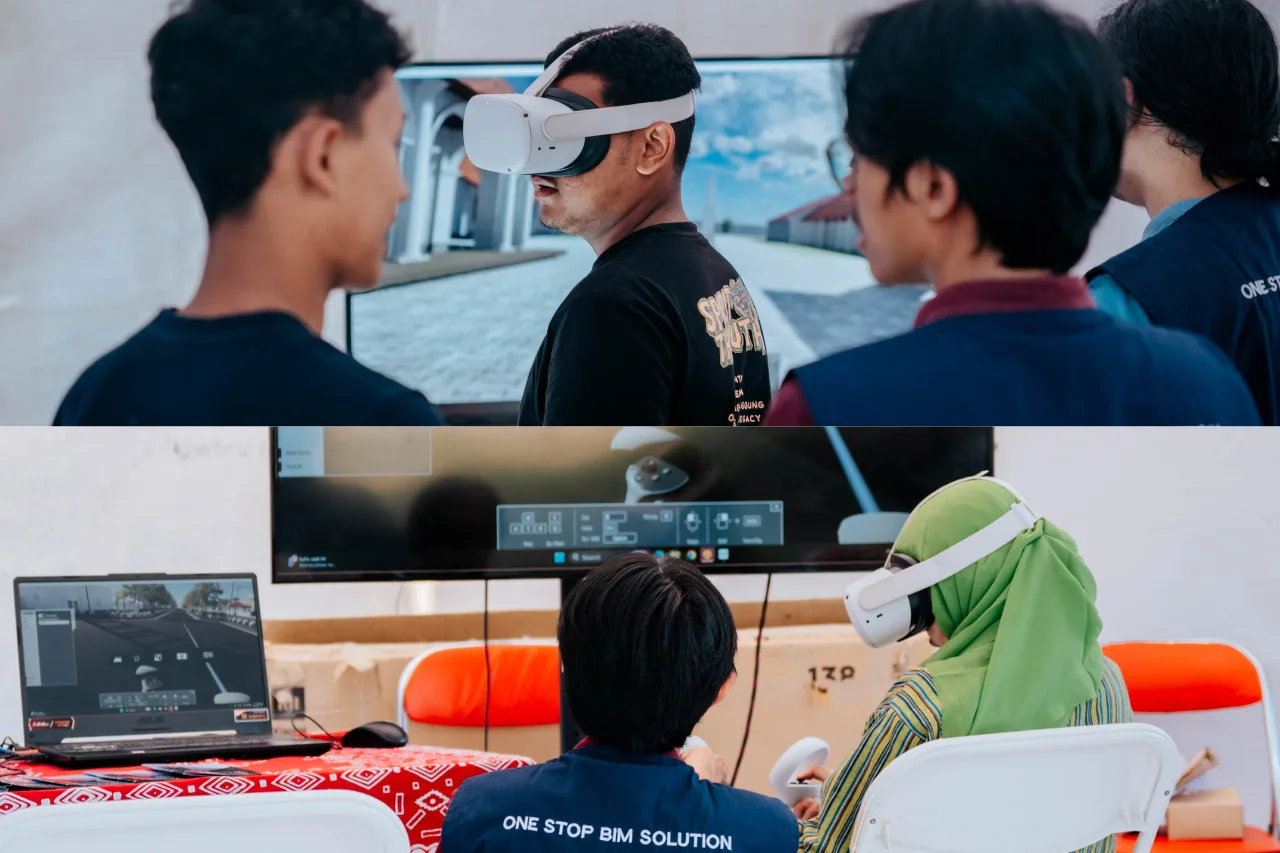
The next stage is the scan to BIM process, where point cloud data is processed into a structured 3D model. In this project, the modeling is carried out at two levels of detail, namely LOD 300 for the core area and LOD 200 for the supporting area.
.webp)
Benefits of 3D Modeling for Wates Area Development
The final result of this process is a 3D model of the Wates City Center area which can be used as a basis for decision-making. This model not only functions as a visualization but also as a comprehensive analysis tool.
Some of the main benefits of implementing BIM-based 3D modeling in the Wates area include:
- Supporting the conservation of heritage buildings with accurate data
- Assisting area planning in a more structured way
- Becoming the basis for urban infrastructure development
- Facilitating simulation and long-term planning
With this digital model, decision-making is no longer based on assumptions, but supported by measurable and analyzable data.
.webp)
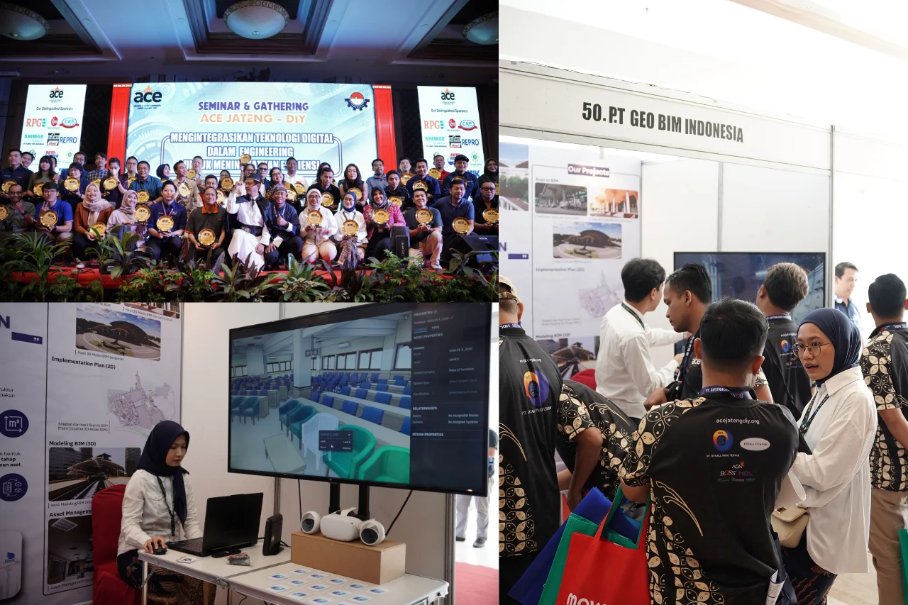
GeoBIM Indonesia as Your Trusted Consultant
In its implementation, projects like this require support from professionals and the right technology. GeoBIM Indonesia is present as a provider of BIM services, scan to BIM, and 3D modeling that prioritizes accuracy and efficiency. With experience in the geospatial and digital modeling field, GeoBIM Indonesia is able to adjust to the needs of each client, both for area-scale, infrastructure, and buildings. Supported by the latest technology and professional teams, every project is carried out with high-quality standards.
The development of strategic areas such as Wates requires a data-driven and technology-based approach. Through the integration of 3D scanning, LiDAR, and BIM, areas can be planned more precisely, efficiently, and sustainably. In the future, digital approaches like this will become the standard in urban development. With accurate and integrated data, every decision can be made more precisely, creating areas that not only grow but also preserve their historical value.