
Scan to BIM Heritage Situs Sokoliman
Project Details
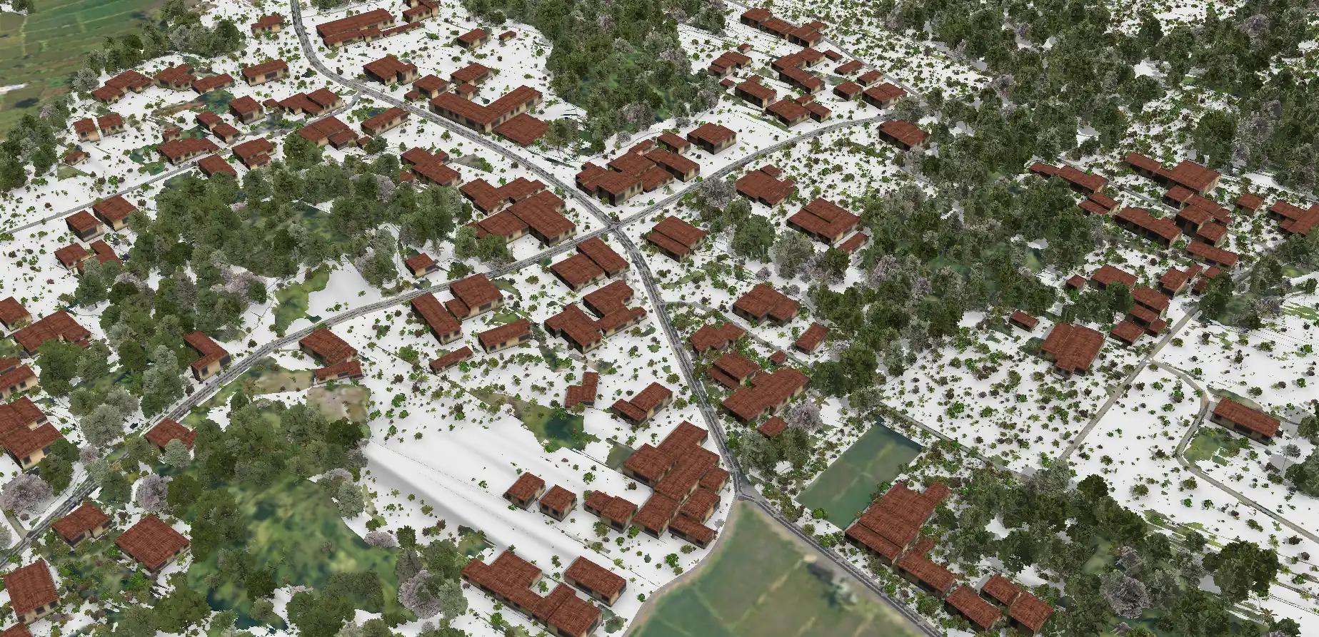
- Location : Sokoliman, Gunungkidul, DIY
- LOD : 200-300
- Area : 2643 Ha
- Data Resources : Point cloud, Scan LiDAR, Orthophoto, Camera 360
- Equipment : GNSS CHC i50, UAV VTOL CHC P330 Pro, Sensor LiDAR AA450, TLS RTC 360
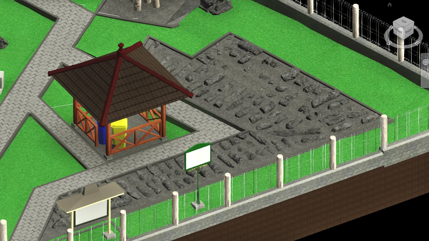
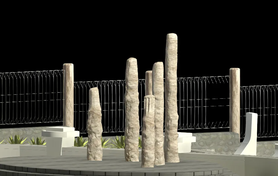
- Project Outputs: 3D Model
- Objectives: To provide comprehensive spatial data for the Sokoliman Strategic Spatial Area that accurately represents existing conditions based on field measurements and data acquisition. The project also aims to develop 3D models that comply with applicable regulations and technical specifications for the following sites: Sokoliman Site, Gondang Legi Site, Pindul Cave, and Longop Cave.
- Project Duration: 60 days
- Year: 2025
Related Projects

Scan to BIM Candi Ijo Heritage Area
View Case Study
Scan to BIM Kotabaru Heritage Area
View Case Study