
Provincial Road Ledger Documents Ngawi

Project Details
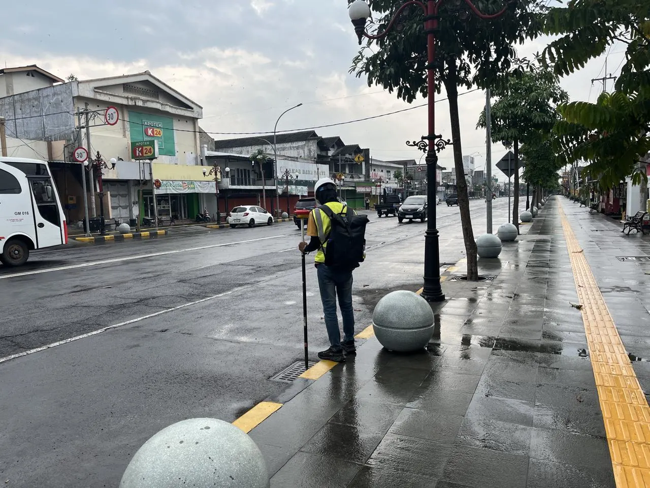
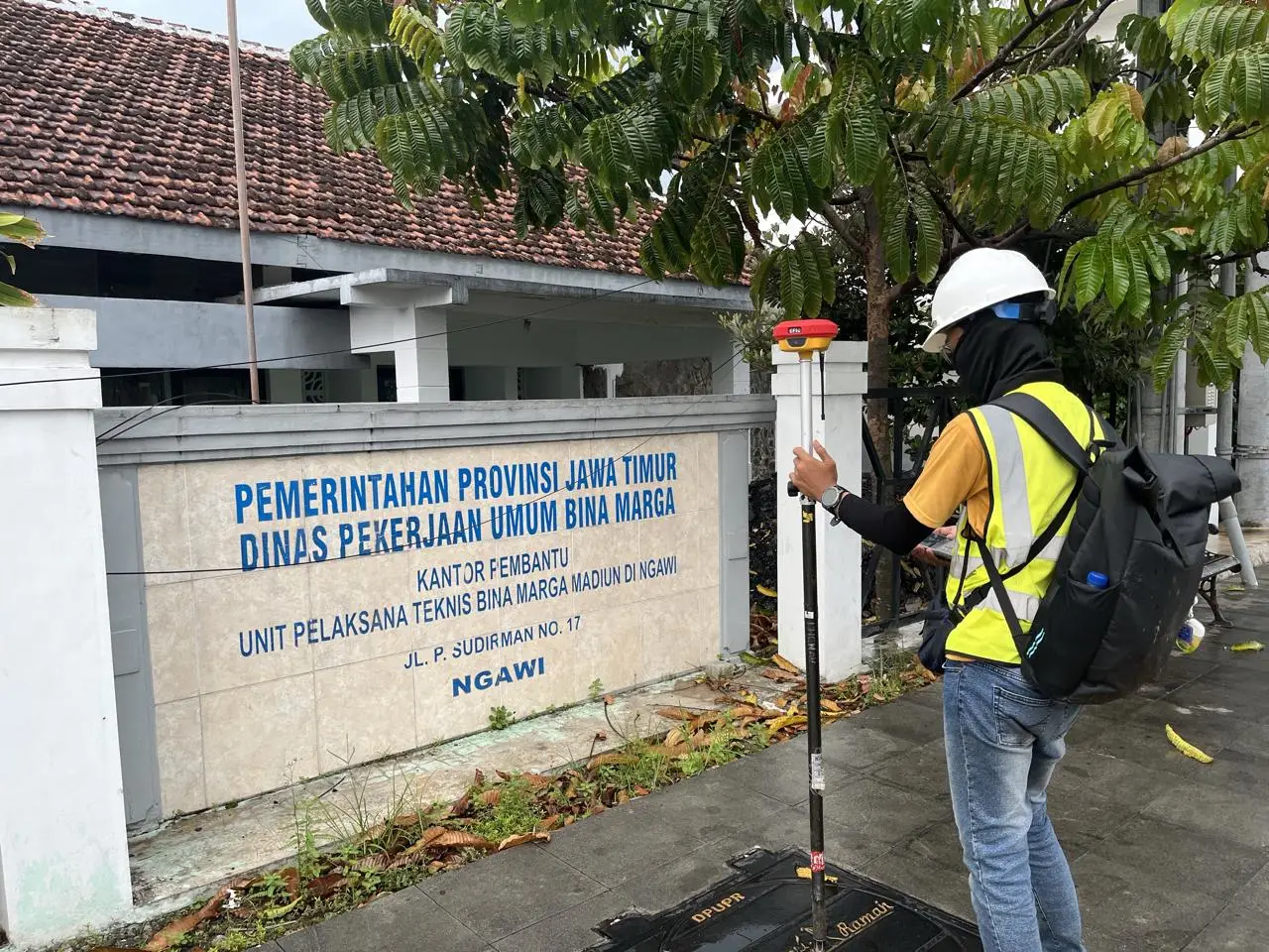
- Location : Provincial Roads in Ngawi Regency: Gubernur Suryo Road, Panglima Besar Sudirman Road, Ahmad Yani Road, Basuki Rahmad Road, Sukowati Road
- LOD : 350
- Area : 91,65 Ha
- Length : 7,058 km
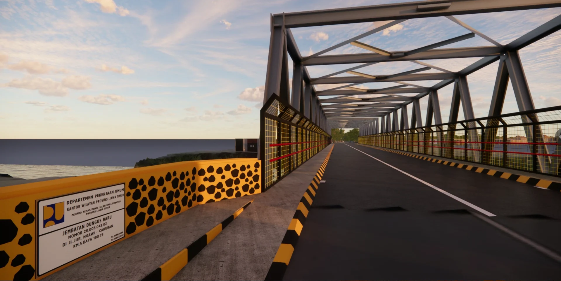
- Data Resource : RTK GNSS field survey for road asset coordinates and elevations, UAV LiDAR point cloud data
- Equipment : Road and bridge ledger documents, field survey measurements, processed point cloud data, 3D Model
- Objectives: To produce official Provincial Road and Bridge Ledger documents for the Ngawi Region.
- Project Duration: 30 days
- Year: 2025
Dinas Pekerjaan Umum Bina Marga, Provinsi Jawa Timur required provincial road ledger documentation in the Ngawi. Based on this need, GeoBIM successfully documented five road sections in Ngawi: Jalan Gubernur Suryo, Jalan Panglima Besar Sudirman, Jalan Ahmad Yani, Jalan Basuki Rachmad, and Jalan Sukowati, completed within 60 days.RTK measurements were carried out to obtain accurate coordinates and elevation data of road assets. Meanwhile, LiDAR point cloud data was processed into models to produce a 3D Road Ledger Model.
Related Projects

Scan to BIM Ship
View Case Study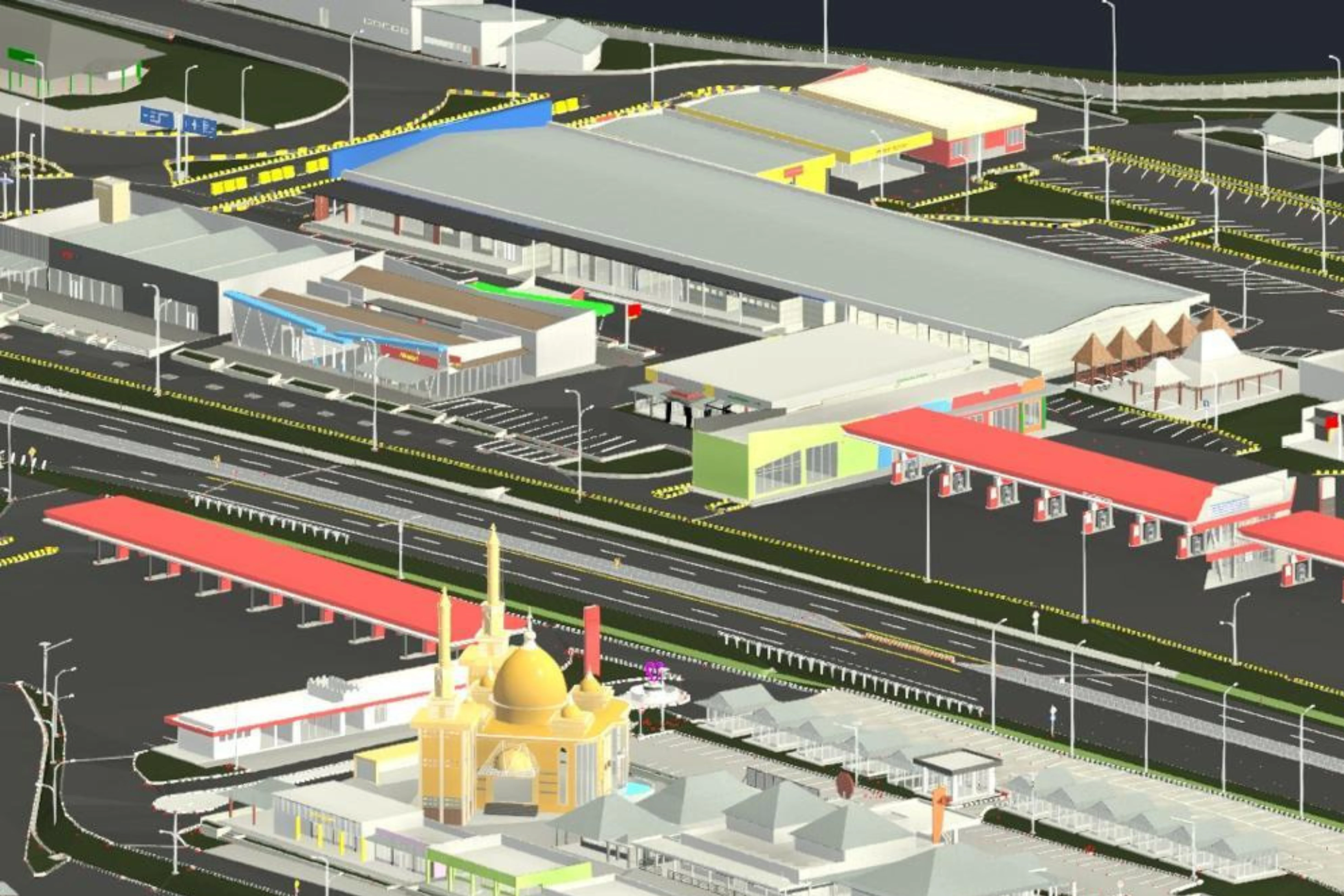
3D Road Ledger Modeling – Cipularang Toll Road
View Case Study.webp)