
3D Road Ledger Modeling Surabaya–Mojokerto Toll Road
.webp)
Project Details
- Location : Jalan Tol SuMo
- LOD: 300-350
- Length : 36,27 km
- Data Resource : As-built Drawings, Point cloud TLS, Camera/Video
- Project Outputs: 3D Model
- Objectives: To develop a 3D model of the Surabaya–Mojokerto Toll Road to fulfill road ledger data requirements.
- Project Duration: 4,5 month
- Year: 2025
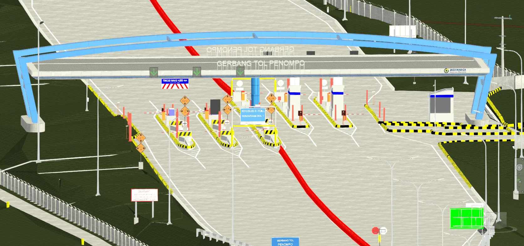
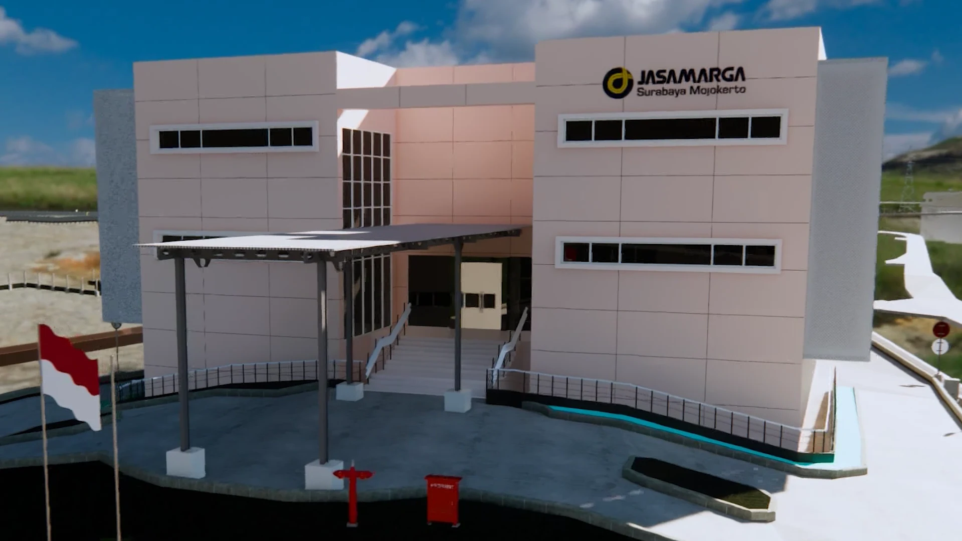
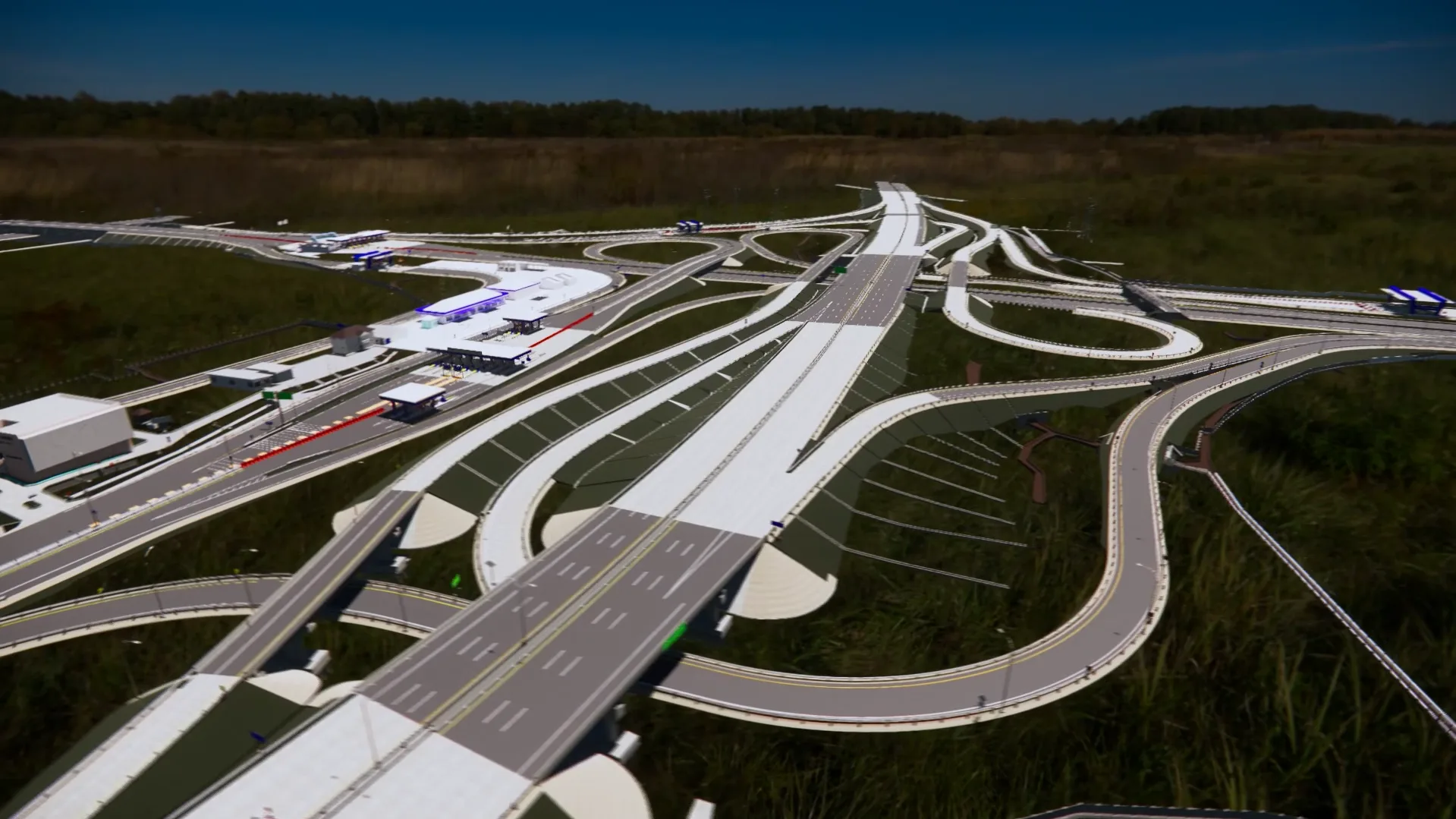
To fulfill the requirements for Road Ledger data, GeoBIM collaborated with PT Globe Anugrah Persada to develop a 3D Road Ledger Model for the Surabaya–Mojokerto Toll Road. The scope included modeling structural assets such as 6 elevated sections, 47 overpasses, 12 underpasses, 2 underbridges, 17 box underpasses, 7 pedestrian bridges, 3 emergency escape ramps, 7 signage units, and 36 utility assets.
In addition, corridor objects were modeled across 12 areas, covering the main road, road markings, guardrails, parapets, and reflectors. Building objects included 12 toll gates, 9 toll offices, and 5 rest areas. The project also delivered 3D models of traffic signs, street lighting (PJU), CCTV, drainage systems, and toposolid for all 12 areas. The project was completed within 4.5 months.
Related Projects
Scan to BIM Ship
View Case Study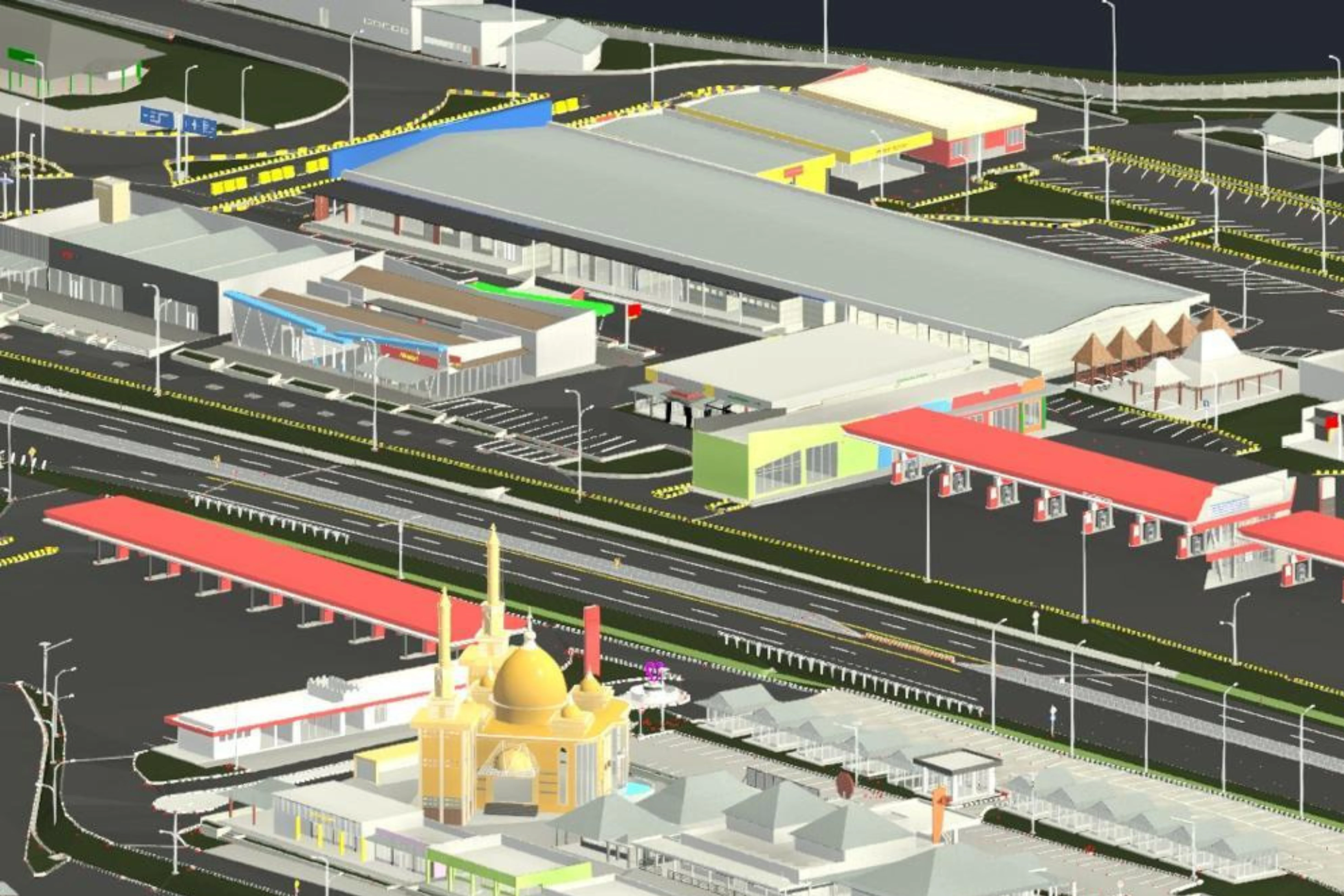
3D Road Ledger Modeling – Cipularang Toll Road
View Case Study.webp)