Missing As-Built drawings is a crucial problem that most frequently causes losses in building renovation and reconstruction projects. In the construction industry, the loss of this vital documentation is tantamount to a real threat of a "botched project".
A project running without valid dimensional data will face a series of expensive problems, including measurement errors, clashes between elements, and cost overruns due to material waste and repeated revisions.
“So, how can you obtain As-Built information for an old building that is missing or was never properly documented?”
Scan to BIM: The Accurate Digital As-Built Solution
Scan to BIM is a modern process that converts a physical object, such as a building or structure, into a highly accurate digital model. This process utilizes high-precision technology, namely a 3D Laser Scanner. A 3D Laser Scanner works by emitting laser pulses to the object. These laser pulses measure the distance to the object to obtain a set of Point Cloud data that forms a 3-dimensional model. This raw Point Cloud data is then processed, including merging and removing unnecessary noise.
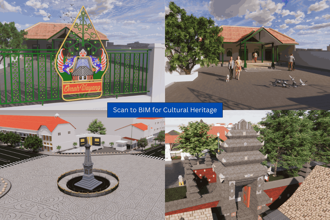
By using Scan to BIM technology, you not only get a digital As-Built but also a 3D building model rich with information. This 3D BIM Model offers value that extends far beyond the reconstruction phase. Besides being an accurate As-Built, the 3D Model can be widely utilized for building facility management, cultural heritage preservation (Heritage BIM), and city planning & spatial arrangement.
What are the Steps in the Scan to BIM Process?
-
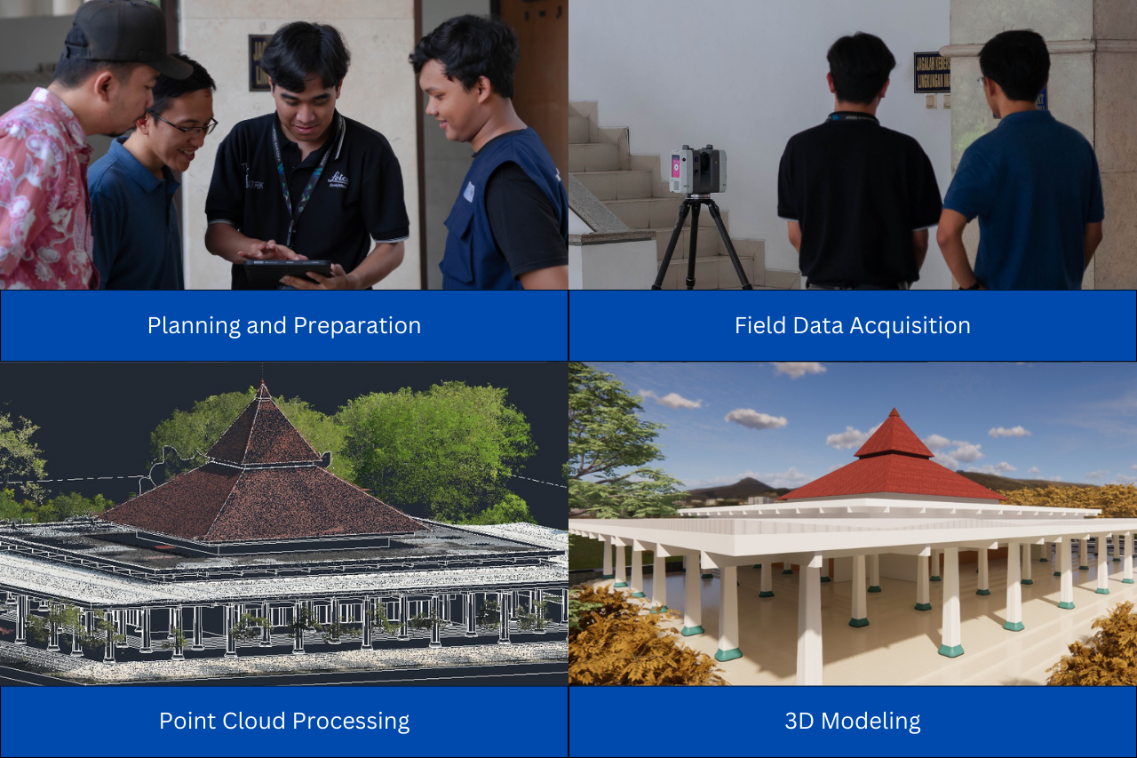
Preparation and Planning
At this stage, the project team conducts a preliminary site survey to understand the existing conditions. The planning stage includes identifying the areas to be scanned, determining control points, preparing the 3D scanner equipment, and drawing up efficient logistical and operational schedules to ensure the scanning process runs smoothly without field constraints.
-
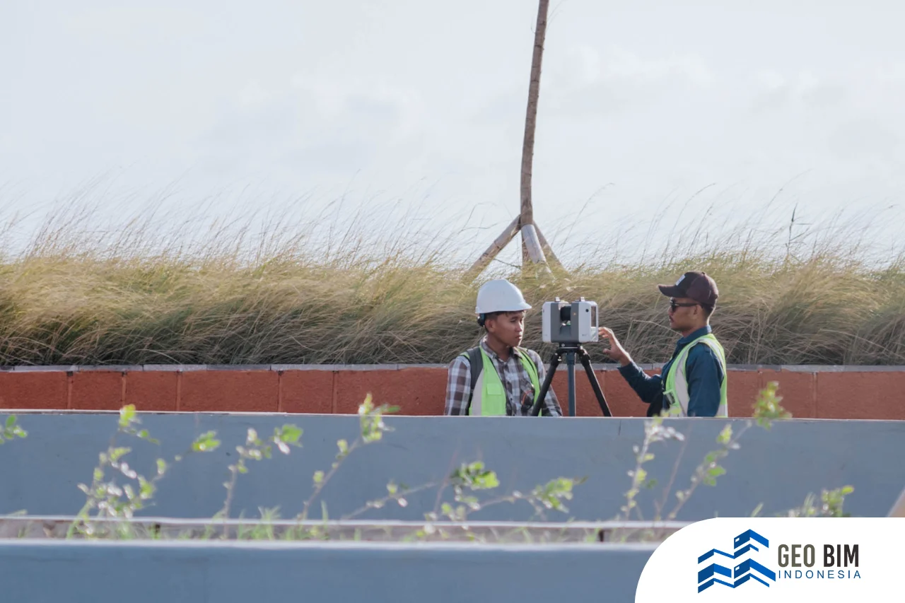
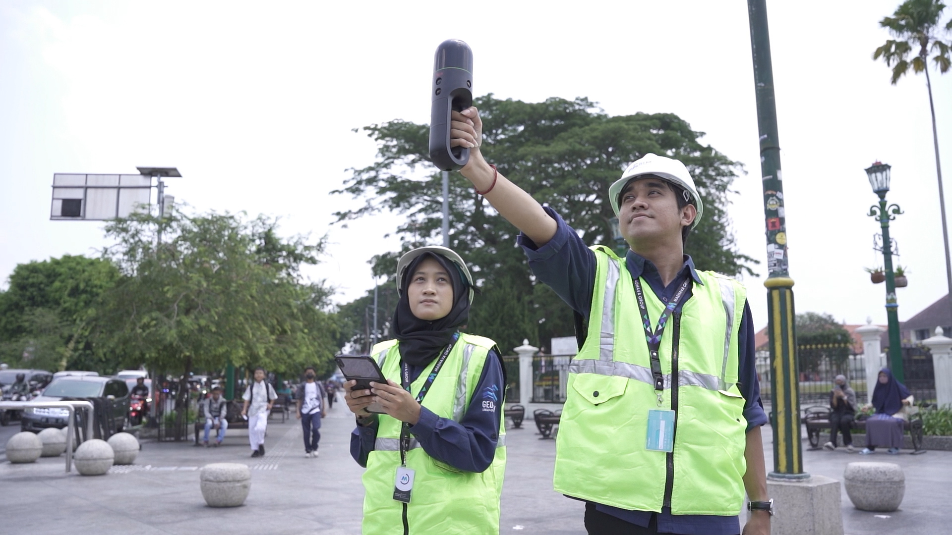
This stage is the physical spatial data acquisition process in the field, where the 3D Laser Scanner device is placed in various strategic positions inside and outside the building to record millions of coordinates. By emitting laser pulses onto the object's surface, the scanner collects high-density data known as the Point Cloud, which accurately represents the building's geometry, including visible architectural, structural, and MEP system details.
-
After the raw Point Cloud data is collected, the Registration process is performed to unify and align all individual scan results taken from various positions into a single, coherent Point Cloud in a uniform coordinate system. Furthermore, the data is processed by performing noise removal (irrelevant data, such as shadows or moving objects) to generate a clean and accurate Point Cloud, ready to be used as a reference for the modeling stage.
-
The registered and filtered Point Cloud is ready to be modeled according to the agreed-upon LOD (Level of Detail), where geometric elements (walls, columns, pipes, etc.) are precisely digitized and supplemented with non-geometric information (such as materials, asset tags, or technical data). The resulting model is then used as the basis for creating the final As-Built model.
Why Should You Use Scan to BIM?
The use of Scan to BIM offers benefits that eliminate risks and improve the quality of your reconstruction project:
-
High Data Accuracy: The BIM Model represents the existing conditions on-site with millimetre-level accuracy, eliminating assumptions and manual measurement errors.
-
Reduced Design Revisions: New designs can be directly adapted to the building's actual condition, minimizing time-consuming and costly revisions.
-
Project Time Efficiency: Field data acquisition time is significantly faster than traditional measurement methods, accelerating the start of the planning phase.
-
Operational Cost Savings: Smart and mature decisions are supported by accurate data, reducing material waste and preventing unexpected cost overruns.
-
Optimal Team Coordination: The BIM Model serves as a single, centralized source of information, ensuring all teams (architects, engineers, contractors) have the same understanding and coordination.
Don't let missing As-Built drawings be the reason your project incurs losses!
Start digitizing your existing assets now with a Scan to BIM-based BIM Model.
GeoBIM Indonesia is ready to assist you in modeling your asset systems according to project requirements at various LOD (Level of Detail) levels, from initial design all the way through facility operations. With experience and deep understanding of international BIM standards, we offer modeling solutions that are precise, efficient, and ready for implementation.
Contact us for a consultation or Scan to BIM services tailored to the scale and complexity of your existing project.
📞 +62 838-3866-5598 (Sales Engineer – GeoBIM Indonesia)
.png)