Since the 1970s, the Gramedia Sudirman Building has been an iconic landmark in Kotabaru, Yogyakarta. More than just a legendary bookstore, the building is part of the Satuan Ruang Strategis (SRS)—areas with strong philosophical, historical, cultural, landscape, and heritage values. As a heritage site, Gramedia holds significance not only as a commercial space but also as a cultural marker that must be preserved in the city’s spatial planning.
Scan to BIM for Urban Heritage
Scan to BIM (Building Information Modeling) is the process of converting 3D scanning data, captured by laser scanners, SLAM scanners, or drone LiDAR into an accurate digital model. For SRS Kotabaru, this method provides the most efficient solution for heritage conservation and urban planning.
-
Efficient Scanning with Handheld SLAM RS10
Preservation efforts began with the Handheld SLAM RS10, which enables rapid and precise scanning even in complex environments. This method captured every detail of the Gramedia building without interrupting surrounding activities.
-
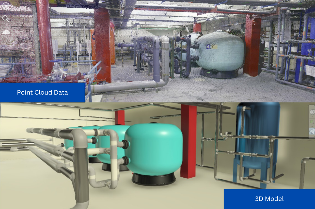
Detailed Point Cloud
The scanning process produced a point cloud, a collection of millions of data points forming a three-dimensional representation of the building. The point cloud carefully recorded every aspect of the structure, from façades and structural elements to architectural details. This dataset serves as a critical foundation for heritage analysis and documentation.
-
Transformation into a 3D Model
The point cloud was then further processed into a 3D model of the Kotabaru area, including the Gramedia building. This model not only serves as visual documentation but also supports various needs: restoration planning, asset management, and heritage conservation strategies.
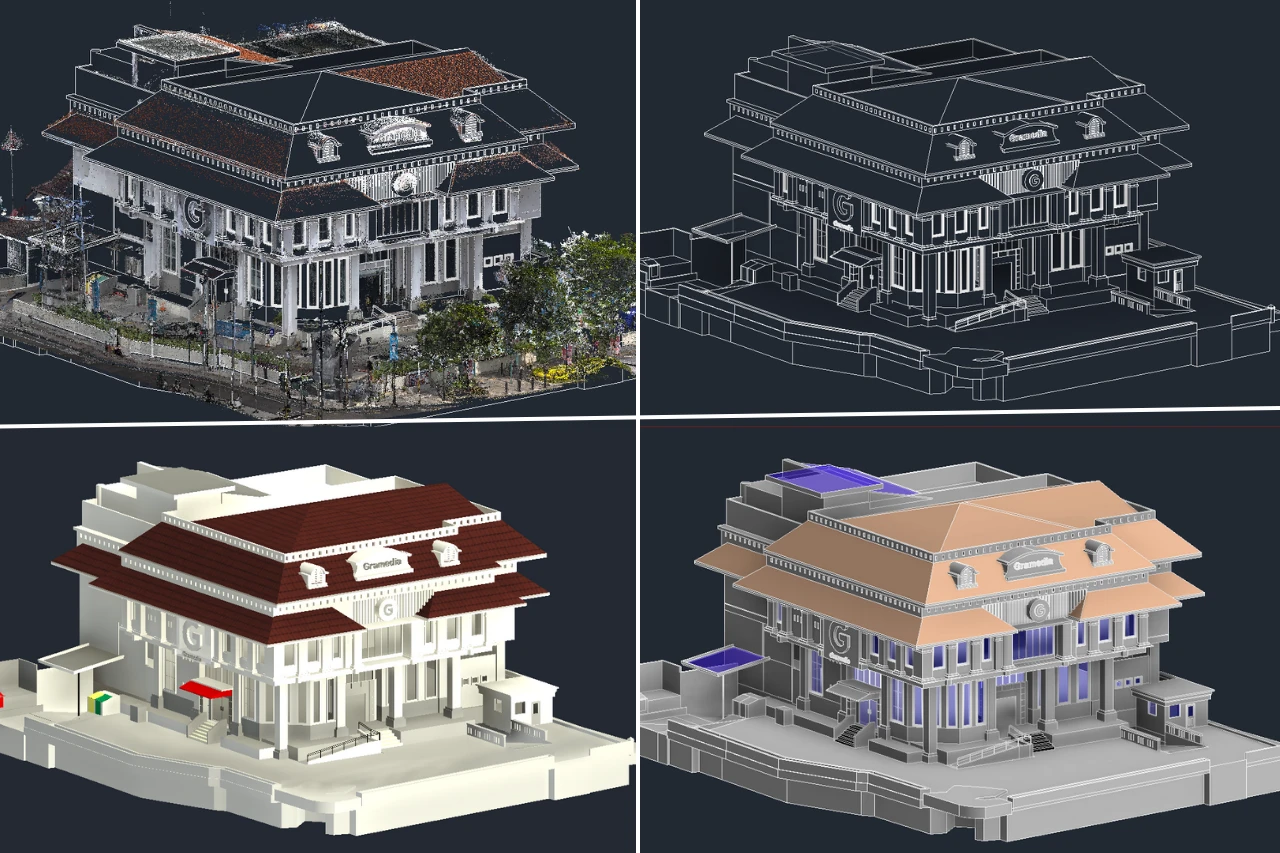
As part of efforts to preserve and manage the area’s spatial planning, GeoBIM Indonesia delivered a Scan to BIM solution. Using the Handheld SLAM RS10, the team conducted scanning to generate a point cloud that recorded every corner of the building with precision. This point cloud data was then transformed into a digital 3D model that not only represents the physical form but also provides an essential basis for spatial planning, renovation, and heritage asset management.
As a specialist BIM consultant in Indonesia, GeoBIM Indonesia is committed to delivering digital solutions that support both preservation and strategic area development. Through Scan to BIM, heritage sites such as Gramedia Sudirman are documented in detail and prepared to support the sustainable development of Kotabaru.
.png)