Have you ever visited Borobudur Temple in Magelang, the Yogyakarta Palace, or Kota Tua Jakarta? Or perhaps you’ve explored other historic buildings in Indonesia, or even around the world?
These places are more than just stone walls or wooden beams; they are silent witnesses to the unfolding story of a nation. Every intricate carving, graceful doorway arch, and carefully planned layout speaks of artistry, philosophy, and a rich cultural legacy. Yet, time, shifting environments, and human activities inevitably pose a threat to their authenticity. Preserving these treasures is not solely the responsibility of governments or historians—it is a shared duty that belongs to all of us.
In today’s digital era, technologies like Building Information Modeling (BIM) serve as a bridge between the past and the future, ensuring that cultural heritage is preserved for generations to come.
What is BIM?
BIM or Building Information Modeling, is a digital method for creating and managing 3D representations of a building or infrastructure along with all related information. It’s more than just modeling. It’s a collaborative process that spans the entire project lifecycle, from planning and design to construction and maintenance.
BIM for Cultural Heritage
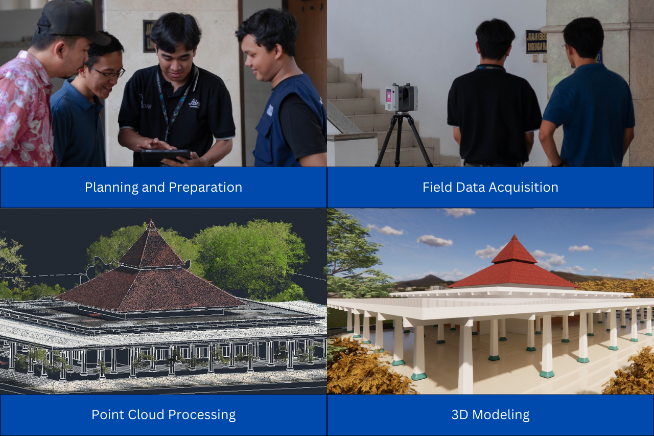
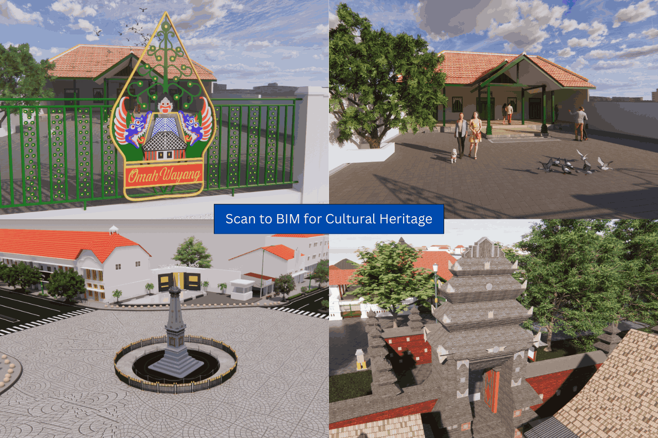
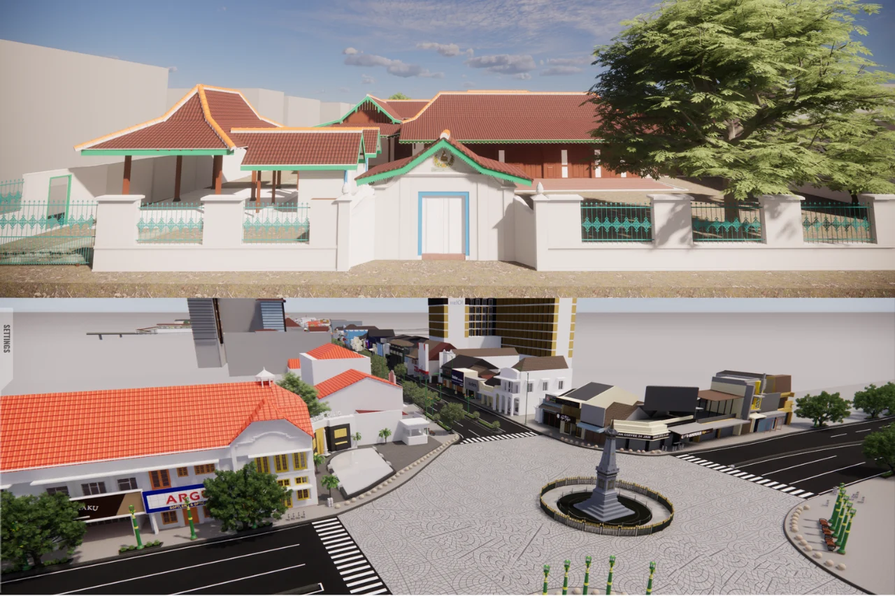
BIM for Cultural Heritage is the application of Building Information Modeling technology to preserve historic buildings, sites, or objects. Through BIM, the existing condition of an object can be digitally recorded in the form of an accurate and information-rich 3D model. This model not only represents the physical form, but also stores detailed data such as materials, structure, maintenance history, and any existing damage. The use of BIM can greatly assist in the restoration and conservation of cultural heritage.
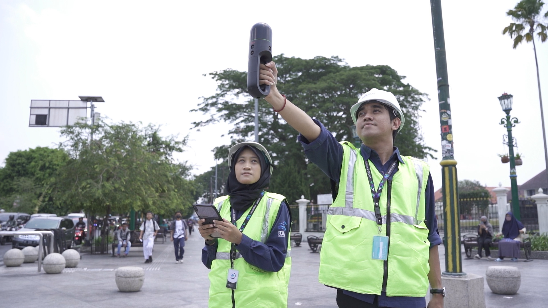
In practice, creating a digital model of cultural heritage can be done using several methods or technologies, including:
-
This method uses laser beams to scan the surface of an object from a certain distance. The scan produces a point cloud with a very high level of detail, which is then processed into a 3D model through the Scan to BIM process. Laser scanning is highly effective for capturing shapes and textures with precision, while remaining safe for fragile historical structures since there is no need for direct contact.
-
This technology uses drones to capture hundreds to thousands of aerial photographs from various angles. These photos are processed into high-accuracy orthophotos. This method enables comprehensive mapping not only of the main heritage object but also its surrounding environment, which can be useful for area analysis.
-
Drone LiDAR
Unlike photogrammetry, LiDAR (Light Detection and Ranging) uses laser pulses emitted from a drone to measure distances and create a 3D model of the earth’s surface. LiDAR excels in mapping areas with dense vegetation or complex terrain. The resulting data can be used to analyze the topographic conditions of a heritage site and help produce more accurate area models.
GeoBIM Indonesia is committed to supporting cultural heritage preservation through the application of BIM technology. From Scan to BIM and 3D Modeling to BIM for Facility Management, every process is designed to document the architectural details of historic buildings with accuracy and safety, without compromising their authenticity.
The resulting digital data serves as a valuable archive for restoration planning, condition monitoring, and even the development of virtual tours accessible to the public. For us, preserving cultural heritage is not merely about maintaining its physical form, but also safeguarding the history and stories behind it, so they can continue to inspire future generations.
.png)