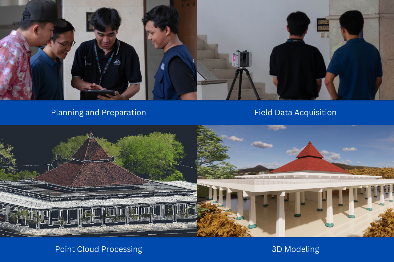
In the world of mapping and surveying, technology is constantly evolving to provide more efficient and flexible solutions. One of the latest innovations that is gaining popularity is Handheld SLAM (Simultaneous Localization and Mapping). This technology combines a LiDAR system with SLAM algorithms to create a 3D model of the surrounding environment in real-time.
What is Handheld SLAM?
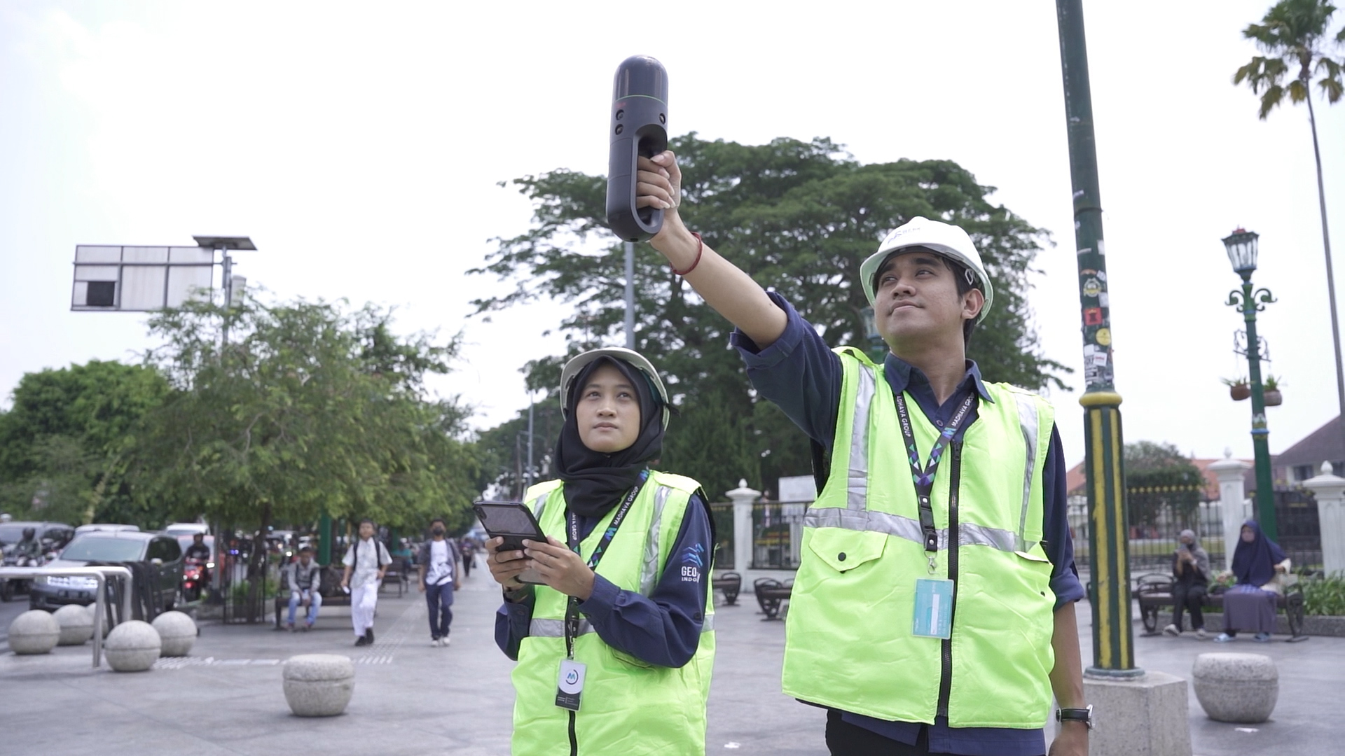
Handheld SLAM is a portable mapping device that enables flexible and dynamic data capture. With its compact size and ease of use, it is ideal for mapping in areas that are difficult to reach by conventional mapping technologies such as TLS (Terestrial Laser Scanner) or LiDAR (Light Detection and Ranging).
How Handheld SLAM Works
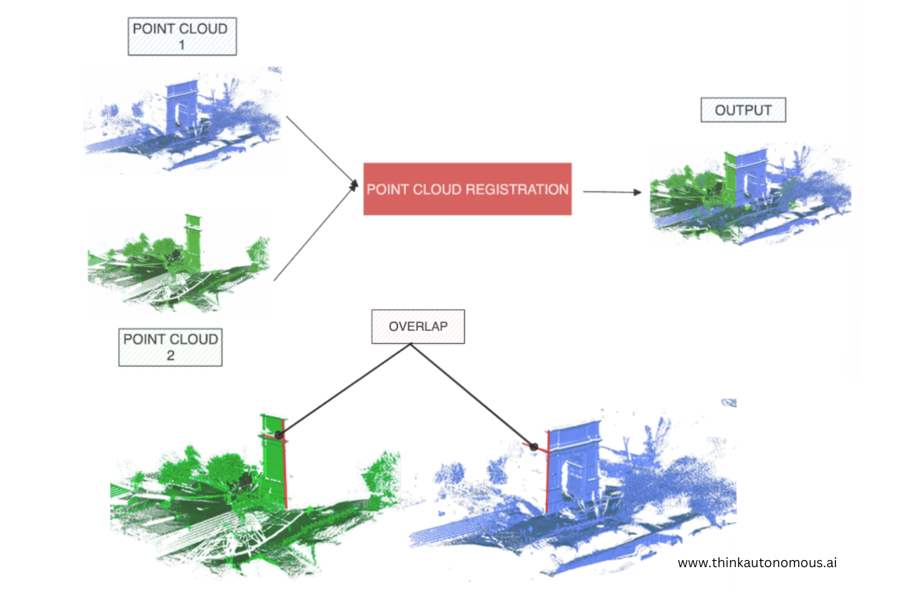
In principle, Handheld SLAM works similar to LiDAR technology. It uses a laser sensor to collect point cloud data from the scanned area. This data is then processed and correlated with coordinate information obtained from the RTK-NTRIP method to improve mapping accuracy. The SLAM algorithm plays a role in aligning and correcting the position data so that the device can perform continuous mapping without the need for external reference points.
Handheld SLAM Advantages
Handheld Slam have several advantages that make them an attractive choice for mapping, architecture and construction professionals:
-
Portability and Flexibility
Compared to conventional mapping systems, Handheld SLAM is lighter and easier to carry, allowing users to navigate hard-to-reach areas, such as narrow passages, forests, or indoor areas.
-
Real-Time Data Processing
This technology enables live data processing as the scan progresses, allowing users to immediately view the mapping results and make corrections if needed.
-
Ease of Use
The SLAM handheld is designed to be easy to operate without requiring complex setup. With this device, mapping can be done by one person without the need for a tripod or complicated additional equipment.
Limitations of Handheld SLAM
Although it has many advantages, Handheld SLAM also has some limitations that need to be considered:
-
Accuracy and Data Resolution
The accuracy of Handheld SLAM is quite high, but still inferior compared to static laser scanners. User movement and environmental conditions can affect the mapping results.
-
Interference from the Environment
Factors such as lighting, surface reflectivity and the presence of moving objects around the scanning area may affect the mapping results.
-
Battery Life
Due to its portable nature, the SLAM Handheld has power limitations. For long-term use, battery recharging or an additional power source is required.
Conclusion
Handheld SLAM is an innovative solution that provides convenience in 3D mapping with a more flexible and efficient approach. With advantages in portability, real-time processing, and ease of use, this technology is increasingly being used in various industries, including architecture, construction, and environmental mapping. Despite some limitations, Handheld SLAM remains an attractive option for those who need a compact yet powerful mapping solution.

.png)