
The digitalization of campus areas is no longer just a trend but a strategic necessity for asset management, development planning, and integration towards a smart campus. Through Scan to BIM technology, GeoBIM Indonesia delivers accurate and comprehensive 3D modeling of the Muhammadiyah University of Yogyakarta, covering an area of 26.2 hectares.
This process was carried out through a combination of 3D Scanning services, detailed 3D modeling, and the preparation of a site plan based on the latest spatial data, ensuring that all physical elements of the campus are accurately represented in a digital format.
Phase 1: 3D Scanning Using TLS and LiDAR
3D scanning was performed using a combination of Terrestrial Laser Scanning (TLS) and Aerial LiDAR to ensure comprehensive geometric coverage. Both methods complement each other in capturing architectural details up to the area's elevation. The 26.2-hectare area was divided into 6 zones to facilitate modeling.
-
Terrestrial Laser Scanning (TLS)
TLS was used to capture physical campus elements from the ground in detail, including building facades, pedestrian walkways, outdoor utilities, and vegetation. Scanning was performed using a multi-station approach across all campus zones to avoid blind spots. A total of 800 scan points were created to ensure high point cloud density. This process yields an accurate geometric representation at the building architecture level.
-
Aerial LiDAR Scanning
Aerial scanning was conducted using a UAV platform with a LiDAR sensor to capture the topography and elevation of the campus comprehensively. Three flight missions were executed to ensure the point cloud density met area mapping standards. LiDAR helps to obtain data on building heights and ground surfaces that cannot be perfectly recorded through terrestrial methods. This elevation information forms the basis for contour and surface model generation. The LiDAR results were then synchronized with TLS to form a high-precision spatial dataset.
Phase 2: Point Cloud Filtering & Registration
The point cloud data resulting from TLS scanning at various points are then merged into a single reference coordinate system, known as the registration phase. Noise filtering is performed to eliminate irrelevant objects such as shadows, pedestrians, or vehicles. The registration phase is crucial to ensure all scan points are precisely aligned without overlap or distortion. The result is a complete dataset ready for segmentation and BIM modeling. This phase ensures that the entire campus model is accurate, stable, and reliable within the Scan to BIM workflow.
Phase 3: LiDAR Processing (DTM, DSM, and Contour)
The LiDAR dataset is processed into a Digital Terrain Model (DTM) to read the character of the genuine ground without surface objects. Next, a Digital Surface Model (DSM) is developed to display vegetation, roofs, and building mass. Both models are important references for analyzing the elevation and site structure of the campus. Contour data is then extracted to support the needs for further design in area planning. The result of this processing becomes the basis for the preparation of a measured and precise site plan. This real elevation information aids in development, building expansion, and area risk mitigation.
Phase 4: 3D Modeling & Site Plan
-
Detailed 3D Modeling
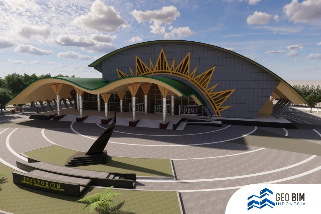
The registered point cloud is converted into 3D Modeling LOD 300–350 for all main campus buildings. Modeling is done based on BIM standards, so every dimension, facade, height, and architectural detail is visualized accurately. A total of 36 buildings were modeled, covering academic spaces, public facilities, laboratories, the sportorium, and student complexes. This model not only displays the 3D form but is also ready to be integrated into the campus management system. All elements can be monitored, analyzed, and maintained on a single digital platform. The final result serves as a digital twin of the campus based on real conditions.
-
2D Site Plan for Area Planning
All Scan to BIM results are presented in a CAD site plan as the spatial representation of the UMY area. This site plan becomes the official reference for subsequent planning needs, new building construction, and renovations. The site plan data ensures that design decisions are no longer based on field estimations, but on actual conditions. Information on utilities, zoning, and connectivity between buildings is also visualized in a structured manner. Thus, the campus can carry out expansion and asset management precisely.
💡 Need Scan to BIM Services for Campuses, Industrial Zones, or Smart Cities?
GeoBIM Indonesia is a provider of spatial and building modeling services based on Scan to BIM, focusing on asset documentation, facility management, area planning, and integration towards a digital twin. GeoBIM works at the scale of buildings, educational areas, industrial zones, and data-driven city development. The entire process is carried out through high-precision 3D scanning and standardized BIM modeling that can be used for planning, evaluation, renovation, or expansion.
Contact GeoBIM Indonesia for your area modeling needs:
📞 +62 838-3866-5598 (Sales Engineer – GeoBIM Indonesia)

.webp)