In many construction projects, Scan to BIM is often perceived as a service with a high investment cost. Many people ask, “Why is it so expensive?”, because the 3D scanning process in the field often looks simple, even giving the impression of merely “walking around” and not taking much time.
In fact, this is precisely where its efficiency lies. Scan to BIM helps reduce survey costs because data acquisition can be completed in a relatively short time, with fewer personnel. The entire existing condition is captured comprehensively in a single survey, minimizing the need for re-measurement and the potential for additional work in the future.
However, the main value of Scan to BIM does not stop at the data acquisition stage in the field. Behind the seemingly quick process, there is a series of complex technical stages that require specialized expertise.
-
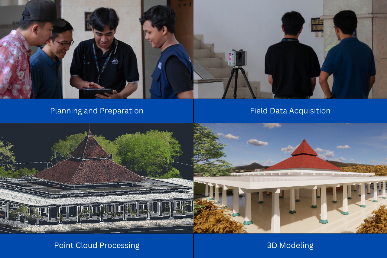
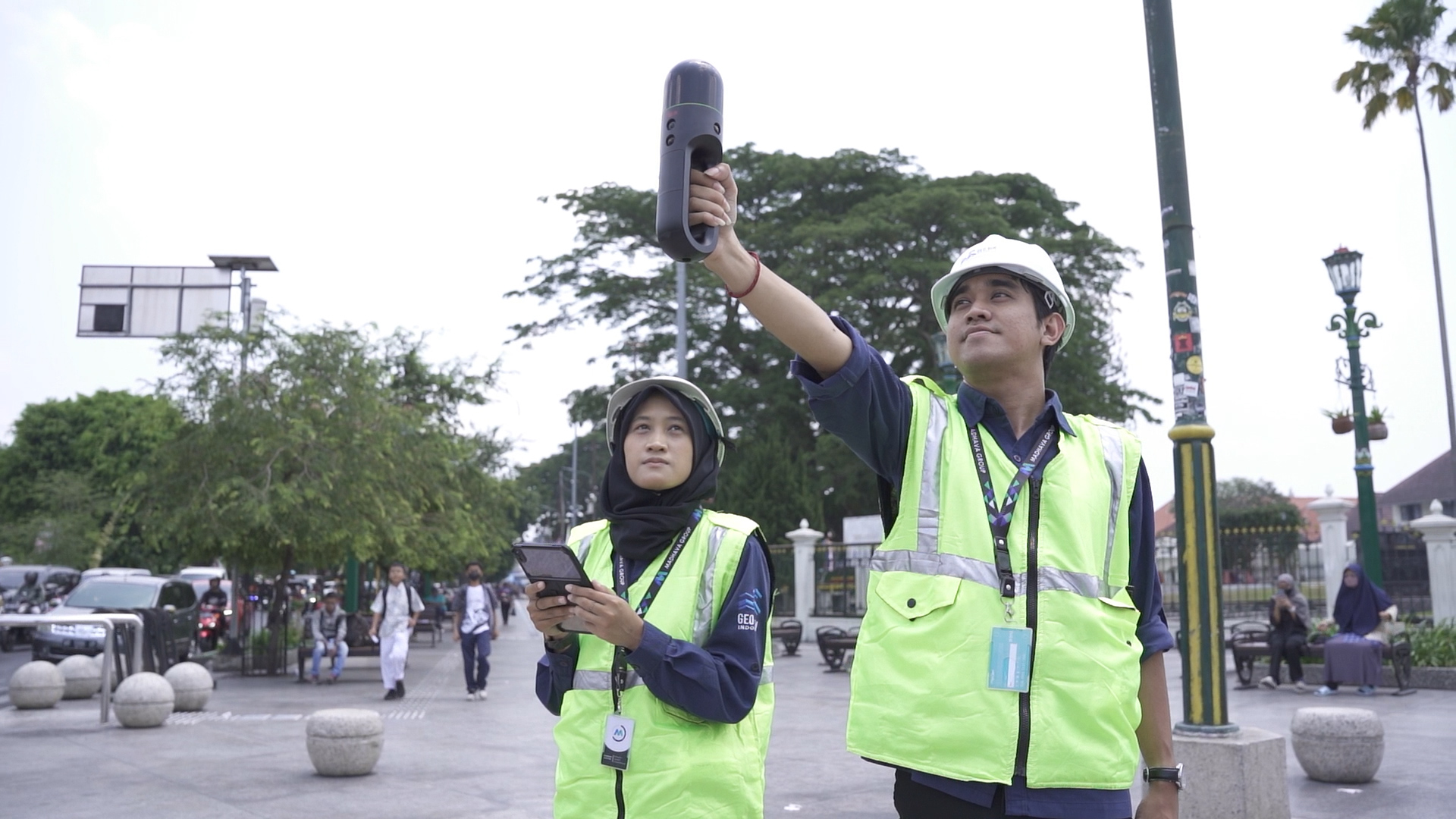
The Scan to BIM process begins with 3D scanning, which often appears simple from the outside. In reality, 3D scanning is not merely a matter of pressing a button. Surveyors must ensure that the instrument position is highly precise, set appropriate scanning parameters, determine the correct scanning distance and angles, and maintain sufficient overlap between scanning points so that the data contains no gaps and object details are optimally captured.
Field conditions further add to the complexity, ranging from pedestrian and vehicle traffic, limited space, to visual obstructions. All of these factors require experience, careful planning, and high attention to detail to ensure that the scanning results truly represent the existing conditions.
-
The result of 3D scanning is point cloud data, consisting of millions of 3D points. This data cannot be directly used for 3D modeling. Point clouds from multiple scanning positions must be registered and merged with high precision. In addition, noise such as moving objects, excessive reflections, and irrelevant data must be thoroughly filtered. This cleaning stage is crucial, as the quality of the point cloud will greatly affect the accuracy of the resulting BIM model.
-
At the 3D modeling stage, modelers do not simply “redraw” objects. They must adjust the Level of Detail (LOD) according to client requirements. Each model element must also undergo a quality control (QC) process to ensure compliance with field data and technical standards. This is what distinguishes professional BIM services from ordinary 3D modeling.
For large-scale or area-based projects, Scan to BIM often needs to be integrated with LiDAR data so that contours, elevations, and environmental context can be accurately represented. This multi-source data integration requires strong geospatial expertise and in-depth technical understanding.
-
Investment in Scan to BIM actually provides long-term benefits. Not only for current needs, the resulting BIM model can also be used to support sustainable asset management. Through the model, asset monitoring and maintenance can be carried out in a measurable manner. In addition, the model can be used for site plan preparation or as-built drawings for renovation or reconstruction planning.
With an accurate 3D model, asset management becomes more efficient, the risk of errors is reduced, and maintenance costs can be strategically controlled.
Scan to BIM with GeoBIM Indonesia
As a provider of BIM services, 3D modeling services, and 3D scanning services, GeoBIM Indonesia delivers Scan to BIM solutions focused on data accuracy, process efficiency, and long-term value for clients. Every stage of the workflow is carried out professionally to ensure the resulting BIM models are fully reliable and ready for use both for construction purposes and facility management.
Scan to BIM is an investment in smarter, more measurable, and sustainable asset management.
Contact GeoBIM Indonesia today and get the best documentation solution for your project!
📞 +62 838-3866-5598 (Sales Engineer – GeoBIM Indonesia)
.png)