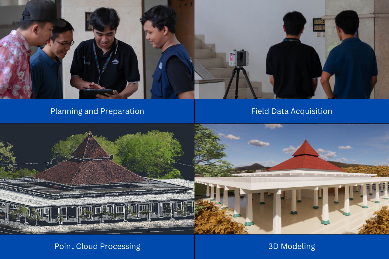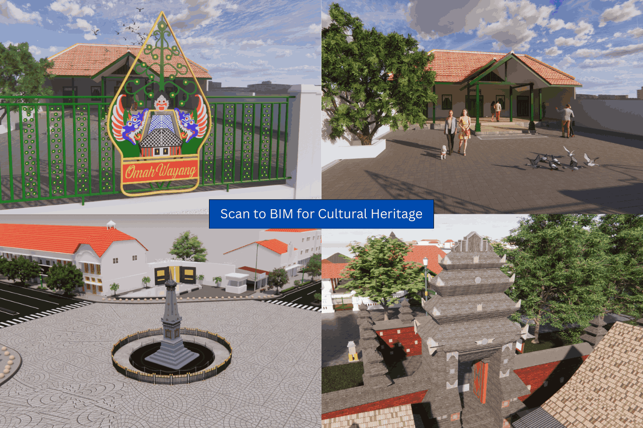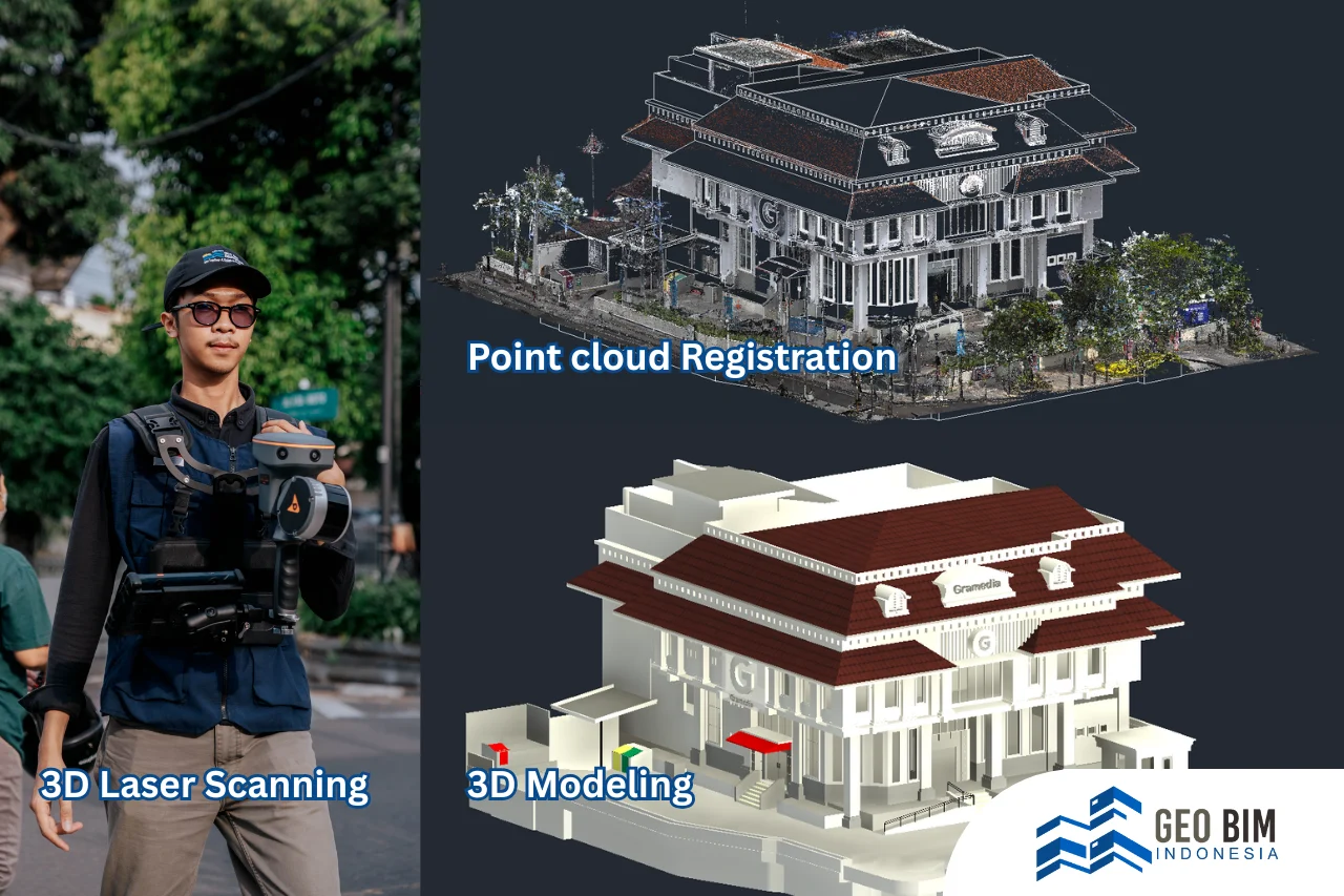
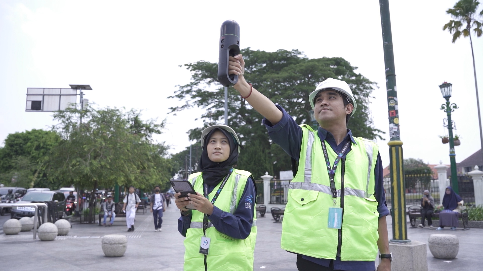
In the modern era of digital construction, **Scan to BIM** (Building Information Modeling) has become a powerful solution to bridge the gap between existing physical structures and their digital counterparts. The process transforms real-world data into intelligent 3D models that can be used across design, construction, and facility management. Let’s explore each stage of this journey, from field data to digital reality. 1. **3D Laser Scanning: Capturing the Existing Condition** The first step begins in the field, where data meets reality. Using **3D laser scanners**, surveyors collect millions (even billions) of data points from every visible surface of a building, plant, or terrain. These points represent the real-world geometry in **three dimensions**. Unlike traditional measuring methods, 3D laser scanning can capture complex geometries, hidden corners, and irregular shapes within minutes. Whether it’s a historical building, an oil refinery, or an infrastructure project, the scanner documents every millimeter. This method not only saves time but also minimizes the need for revisits to the site, since all information is already recorded digitally in high detail. 2. **Point Cloud Registration: Merging the Scans** A project often requires multiple scans taken from different positions and angles to cover every area. At this stage, the collected scans are **aligned and merged** into a unified coordinate system through a process called registration. The result is a point cloud, a dense 3D dataset where each point carries accurate spatial information (x, y, z coordinates). Registration ensures there are no overlaps, gaps, or misalignments, creating a seamless representation of the existing condition. 3. **3D Modeling: From Point Cloud to BIM** Here’s where raw data becomes valuable. Using software, experts interpret the point cloud and reconstruct it as a **BIM model**. This model doesn’t just look like the real thing, it is the real thing, digitally. Every wall, beam, door, pipe, and piece of equipment is modeled with the correct dimensions and materials. Depending on the project’s needs, the model can be developed at different **Levels of Detail (LOD)**: from LOD 100 (conceptual geometry) to LOD 500 (as-built accuracy). Each LOD defines how much information is embedded, such as object parameters, material data, or maintenance schedules. The result: a smart, information-rich model that forms the core of digital construction and asset management. 4. **Quality Control: Ensuring Accuracy and Consistency** Accuracy is everything in BIM. Before being finalized, the model undergoes quality control and validation, where it’s compared against the original point cloud to ensure every element aligns correctly. This step identifies and corrects any deviations or modeling errors, guaranteeing the digital model reflects the real-world condition within acceptable tolerances. Beyond geometric accuracy, QC also checks data consistency, such as naming conventions, metadata completeness, and compliance with modeling standards. This ensures the BIM model is not only correct but also ready for collaboration across disciplines. 5. **Data Utilization: Turning Models into Actionable Insights** Scan to BIM transforms raw field data into actionable intelligence, improving decision-making and efficiency across the asset’s entire lifecycle. Once the BIM model passes validation, it becomes a powerful asset for multiple stakeholders. The same model can be used for: - **Design and renovation planning**: visualizing how new elements integrate with existing structures. - **Clash detection and coordination**: avoiding costly conflicts before construction begins. - **As-built documentation**: serving as an accurate record of the built environment. - **Facility management and maintenance**: tracking assets, scheduling repairs, or simulating energy performance.
GeoBIM: Your Trusted Partner in BIM Excellence
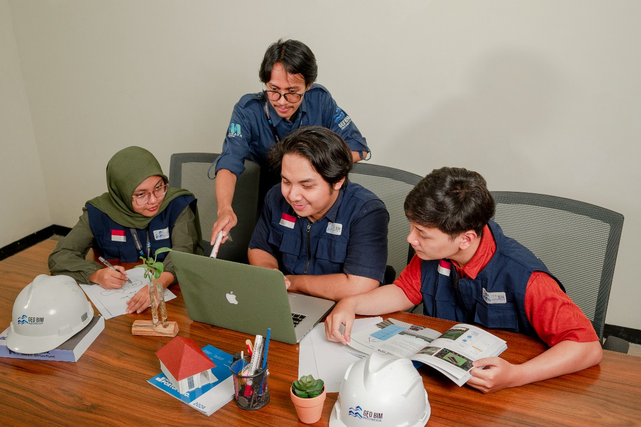
GeoBIM Indonesia delivers comprehensive and integrated Building Information Modeling (BIM) solutions, from precise 3D laser scanning to fully developed digital 3D models ready for implementation. Our services go beyond modeling. GeoBIM provides advanced facility management analytics, enabling clients to monitor, maintain, and optimize their building assets through a seamless and intelligent digital workflow. With this end-to-end approach, clients no longer need to manage separate teams, hardware, or data processing tasks. Every phase, from field data acquisition and 3D model creation to facility management integration and as-built documentation, is executed by GeoBIM Indonesia’s skilled and dedicated professionals. Contact GeoBIM Indonesia today and get the best documentation solution for your project! 📞 +62 838-3866-5598 (Sales Engineer – GeoBIM Indonesia)
.png)